
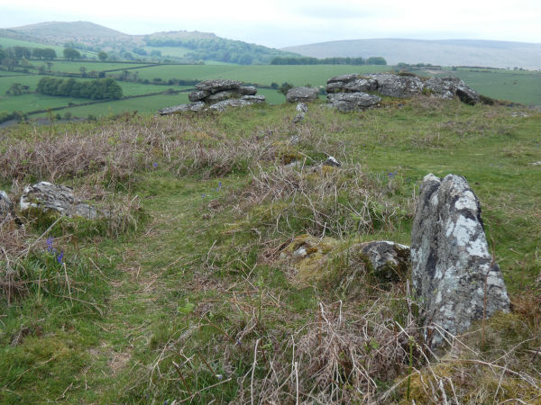
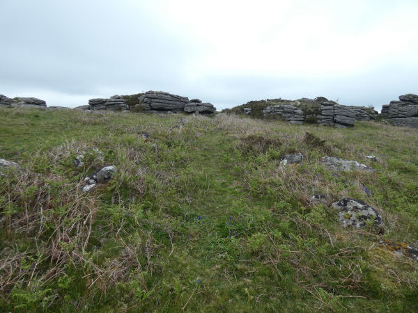
Hayne Down Passageway
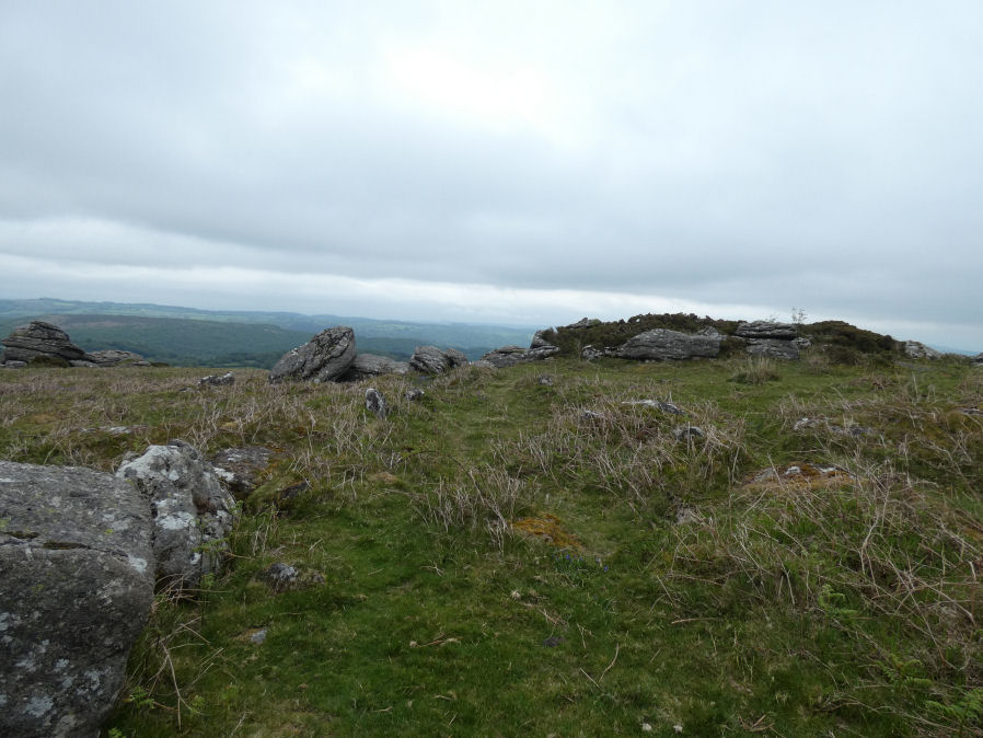
Photo taken on 06-05-2026
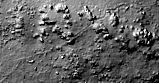
The passageway can be seen on LIDAR
Database entries
OS Map: SX 74425 80126
OS Source: Garmin
HER: MDV8801
Alternate name: Hayne Down
Short Name: PW HayneDn
Butler map: 21.1
Butler Vol 5: p.85 & Fig.49
Exist: Yes
Record: Unique
Record Source: PDW
Hut Class: No
Dimensions (m): 200 x 2
Lidar: SX 74425 80126
Guide Map: 30
Nearest Bus Stop (Minor): Swallerton Gate (1.4 km) [Route: 271]
Nearest Bus Stop (Major): Lustleigh Bishops Stone (4.4 km) [Route: 178]
Nearby sites: SX 74425 80126
Notes
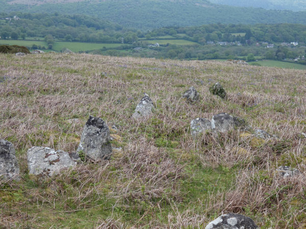
Butler: Prehistoric settlement on Hayne Down includes a passageway which winds through the rocks and seems deliberately designed to give the only access across the ridge. Bounded by close-set slabs and natural rocks this Bronze Age road is about 200 metres long by 2 metres wide and unusually open at both ends. One side forms the southern boundary of a large Prehistoric field occupied by two huts alongside the opposite wall, one of them built into the bank of a small D-shaped enclosure. A passageway along the edge of the field here stops well short of the enclosure, which was entered next to the hut between a still visible pair of slabs set across the bank. This is the only one of the six passageways on Hayne Down which leads in the direction of a hut, the others providing access between fields. The other hut of 4.6 metres diameter lies a few metres uphill. The barrier continues south-east from the summit rocks as a slab wall. A square enclosure is built on to the reave. Other details: Map 21, Site 2.The author visited this feature with Steve Szypko on 06/05/2026. It is an extraordinary feature running for 200 metres at around 2 metre wide. According to Butler there are several passageways in the field system on Hayne Down but this one is exceptional weaving as it does through the south-eastern summit rock outcrops.
There is a good coverage of this feature by Butler with a plan (fig 21.1) on p.152 of Volume One. There is a section on Passageways within field systems on pp.82-85 of Volume 5 with a plan (fig 49) of another passageway on Hayne Down a little to the north of the south-east summit outcrop that contains this feature.
The following photos were taken on 06/05/2026.
References
These are selected references with an emphasis on out of copyright sources linked as PDFs. For more detailed references try any linked HER or PMD record above.
- Butler, Jeremy, Dartmoor Atlas of Antiquities, vol.1: The East, (1991)
- Butler, Jeremy, Dartmoor Atlas of Antiquities, vol.5: The Second Millennium B.C., (1997)
- Fleming, Andrew, Dartmoor Reaves: Investigating Prehistoric Land Divisions (2nd edition), (2008)