
Devils Tor Reported Cist

Photo taken on 22-08-2026
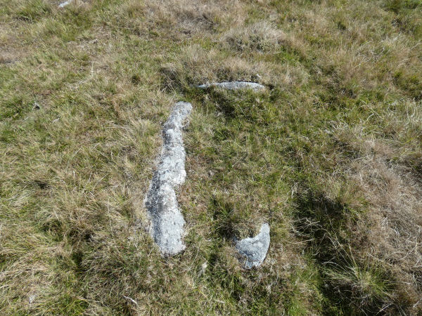
Photo 22/08/2026
Database entries
OS Map: SX 59494 79422
OS Source: Garmin
HER: MDV4217
Alternate name: Devils Tor 3
Short Name: CT-DevilsTor 3
Exist: Yes
Record: Unique
Record Source: PDW
Hut Class: No
Lidar: SX 59494 79422
Guide Map: 25
Nearest Bus Stop (Minor): Powder Mills (5.7 km) [Route: 171(20/07/26 to 19/09/26)]
Nearest Bus Stop (Major): Two Bridges Hotel (4.6 km) [Route: 98,171(20/07/26 to 19/09/26)]
Nearby sites: SX 59494 79422
Notes
This feature was reported by Russell Chapman to Bill Radcliffe. In 2020 the current author was visiting Beardown and had mentioned this to Bill who suggested that it should be checked out. The grid reference given by Russell was SX 59475 79416. There is a stone lined pit at SX 59479 79414 which is very close to the grid reference given and this author had mistook it for the feature on 15/09/2020. On looking again on 23/08/2026 there is far more cist like feature around 20 metres to the east at SX 59494 79422. Unfortunately I had missed that in 2020. This is most likely to be Chapman's reported cist and this record has now been updated with the correct photo and grid reference. Is this a cist? It certainly looks like one but it is hard to be sure as to whether or not it is a natural arrangement.How did I get this so wrong in 2020?
For the record and as a lesson in how it can go wrong - it is interesting to address that question.
This is the photo previously attached to this record:
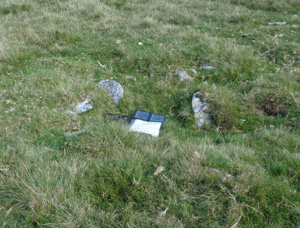
I wrote in 2020 The feature is a rectangular pit lined by small stones. It does not have the appearance of a Bronze Age cist. The nature and function of this feature is unclear but would seem most likely to be relatively modern. The author would like to thank Russell and Bill for the details.
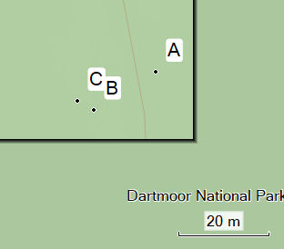
A = location of possible cist as seen 22/08/2026
B = location of what I had assumed was being talked about in 2020
C = location as recorded and reported by Russell Chapman
A grid reference just a little inaccurate when you believe it to be accurate can mislead and on a time limited walk I had not searched the wider location thoroughly enough having believed I had already found the feature in question.
The HER record MDV4217 has been moved to the west and now roughly coincides with this feature - it didn't previously. On that basis that record is now being matched with this feature although the match is uncertain, it could relate to site B.