
Hameldown N.E. Stone Row
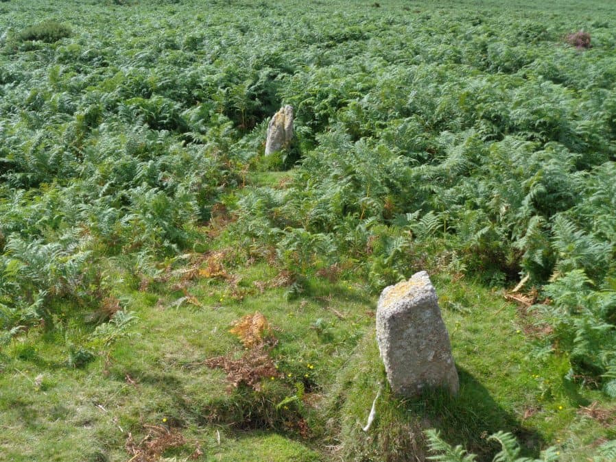
Photo taken on 01-04-2026
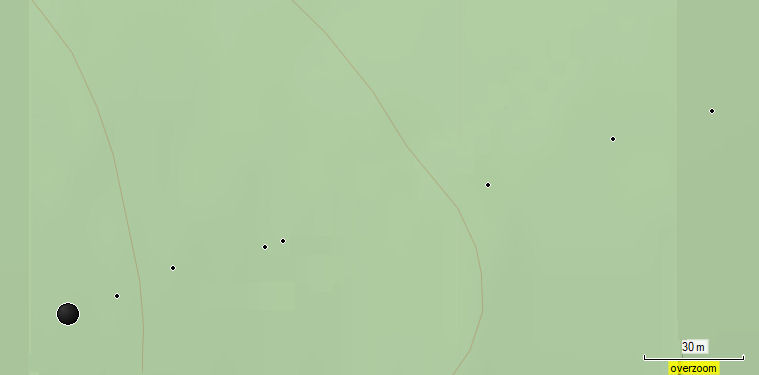
Plan by Gerrard updated by the author with addition of Stone A and Stone B.
Database entries
OS Map: SX 71481 80095
OS Source: SRGB
HER: MDV18865
Megalithic Portal: 6333472
The Stone Rows of GB: Hameldown
PMD: Berry Pound Stone Row
Alternate name: Hamel Down
Short Name: SR Hamel NE
Butler map: 20.3
Exist: Yes
Record: Unique
Record Source: PDW
Hut Class: No
Dimensions (m): 217
Lidar: SX 71481 80095
Guide Map: 29
Nearest Bus Stop (Minor): Swallerton Gate (3.4 km) [Route: 271]
Nearest Bus Stop (Major): Postbridge Bellever (6.6 km) [Route: 98]
Nearby sites: SX 71481 80095
Notes
Fleming (1983): stone row sse of berry pound. There is a cairn at the west end at sx71488010. The minimum length of the row is 217 m: it may be longer. It is largely destroyed: 5 upright stones, one leaning, one uprooted, and three stoneholes are still visible. Orientation 270 degrees. In one place there is evidence that it was a double row.Described in Butler Volume 1 Map 20.3. To the south of Berry Pound is a small longhouse. Within the abandoned field 250m south of the longhouse are the probable remains of a single stone row first recorded in 1983. Five or six stones remain in line up to 206 m apart the rest having been removed or buried when the field was ploughed. Uphill the row is orientated towards a mound and pit just beyond the field boundary which takes a dog-leg around it, possibly the remains of a damaged cairn. The last stone downhill stands 0.8 m high about 100 m from the stream.
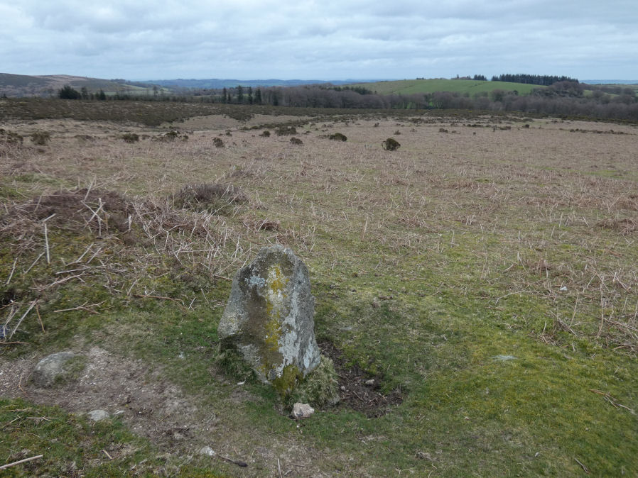
View along row from stones 2 and 3. Stone A can be seen in the distance a little off line. Photo 01/04/2026
The author visited the site with Steve Szypko on 01/04/2026 and 08/04/2026. The plan below is based on Garmin waypoints taken on those dates. We used Gerrard's original plan as a guide to find the stones. With the stones numbered from the western cairn we did not find the fourth "missing" stone in Gerrard's plan but can confirm the ground is disturbed and could be the location of a removed stone.
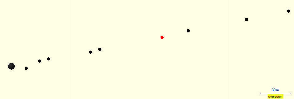
Plan from combined GPS surveys done with Steve Szypko on 01/04/2026 and 08/04/2026. The location of a missing stone is indicated in red (after Gerrard).
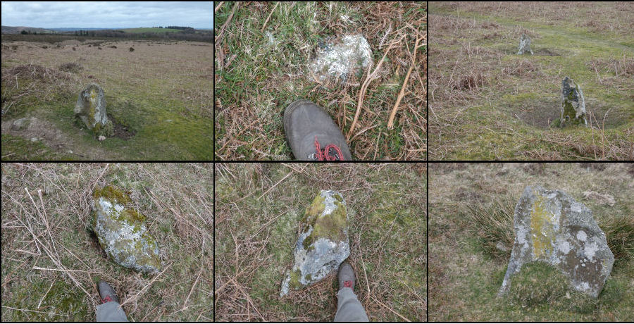
The montage of photos includes a possible stone (Stone B) although that is very close to the reave - that is the third point in the plan. There are 6 photos in the montage covering all the stones in the row if it is considered as a single row i.e. without Stone A.
Montage Top Row: Stones 1, B, 2-3
Montage Bottom: Stones 5, 6, 7
Our survey produced the following grid references:
Cairn SX 71487 80100
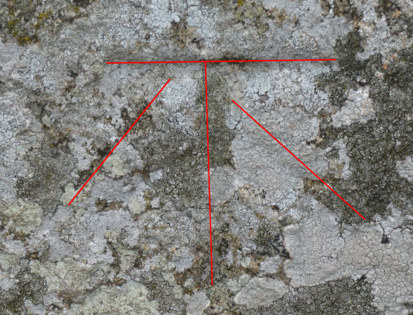
Stone A SX 71498 80100 (benchmark stone)
Stone 1 SX 71508 80105 (not in montage)
Stone B SX 71517 80108 (possible stone but could be from the reave)
Stone 2 SX 71548 80114 (pair)
Stone 3 SX 71554 80115 (pair)
Stone 4 SX 71601 80125 (Missing stone from Gerrard plan - NGR estimated from plan).
Stone 5 SX 71623 80130
Stone 6 SX 71666 80143
Stone 7 SX 71699 80151
We had missed Stone 1 on Gerrard's plan on the first visit having initially confused Stone A with it. The reave cuts across the row and Stone 1 is just the other side of the bank which we found on the second visit.
Stone A can be seen in the plans to be closest to the cairn and a bit out of line with the rest of the stone row. It is likely it was excluded from Gerrard's plan as not being part of the row but Fleming stated that "In one place there is evidence that it was a double row." For this reason we have added it to the plan.
Stone A is included here as not in the photo montage (08/04/2026)
There is an OS benchmark on Stone A which is clearer in this annotated closeup.
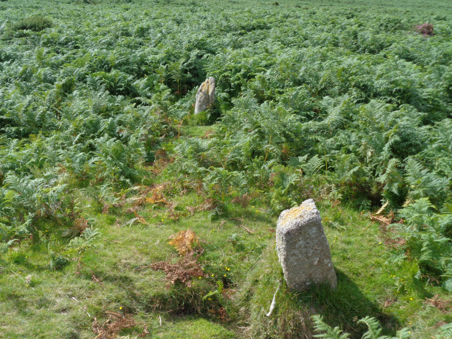
The following photo of the pair of stones (3 and 2) was taken by the author on 19/08/2017. The row is likely to be overgrown with bracken in the summer.
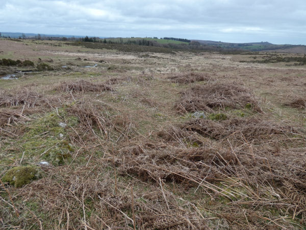
We looked for the cairn marked on Gerrard's plan at SX 71481 80095 and on the first visit we failed to find the cairn as it looked like confused remains of walling. This contradicted the account from Fleming, Butler and Gerrard and on the return visit we found the badly damaged cairn as reported by those authors.
Hamel Down N.E. row Cairn
We surveyed the row on both visits and the combined data is in our plan. The author superimposed our Garmin plan over Gerrard's plan and the match is very good. This allowed the addition of Stone A (benchmark stone) and Stone B (buried stone close to edge of reave). Gerrard has kindly given permission to update and use his excellent plan with these two additions.
It is intersting to note that Bill Radcliffe's Prehistoric Monuments of Dartmoor's entry states that the row "Possibly extends a further 200m uphill, in the direction of Broad Barrow. This would put the cairn in the middle of the row."
Medieval longhouse
The other feature of interest is the nearby medieval longhouse located at SX 71438 80356 (MDV8819). The photo here is looking downhill and shows this is typically heavily overgrown. The partition wall can just be made out under the bracken die back.
References
These are selected references with an emphasis on out of copyright sources linked as PDFs. For more detailed references try any linked HER or PMD record above.
- Butler, Jeremy, Dartmoor Atlas of Antiquities, vol.1: The East, (1991)
- Fleming, Andrew, The Prehistoric Landscape of Dartmoor Part 2: North and East Dartmoor , Proceedings of the Prehistoric Society , Volume 49 , Issue 1 , pp. 195 - 241 (1983)