
Kennon Hill Cairn Circle
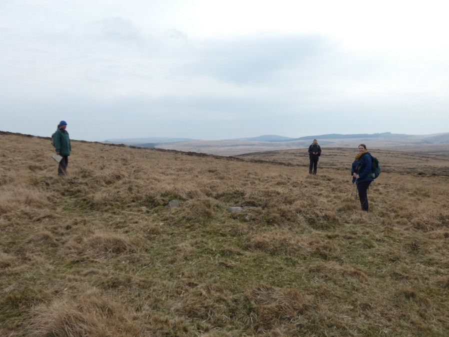
Photo taken on 10-03-2025
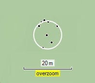
Waypoint data of stones in circle 10-03-2025
Database entries
OS Map: SX 64213 88723
OS Source: Garmin
HER: MDV130499
Alternate name: Kennon Hill
Short Name: CC Kennon Hill
Exist: Yes
Record: Unique
Record Source: PDW
Hut Class: No
Cairn Class: Yes
Lidar: SX 64213 88723
Guide Map: 8
Nearest Bus Stop (Minor): Wonson Telephone Box (4.2 km) [Route: 670]
Nearest Bus Stop (Major): Ramsley (4.5 km) [Route: 670,671,6A]
Nearby sites: SX 64213 88723
Notes
This cairn circle has a diameter of 10 metres or approx 30 feet. It has a slab in its centre which matches the 1894 report by R.N. Worth except for the size and distance/location of the Buttern Hill stone circle. The central area of the circle is raised and the circle has a ring or bank. The raised centre suggests it is not a round house.R.N.Worth Throwleigh [Buttern] circle is also noteworthy for having a companion, a short distance on the slope to the westward. The existence of this circle has not been put on record until now, and indeed it might well escape observation, seeing that there are only four certain stones still standing, with possibly a fifth, and that the remainder have disappeared. This circle was clearly not less than 60 feet in diameter. There is a very large block of irregular outline within its limits, which at one tirne may have stood fully six feet high. Menhirs occur in circles in Cornwall.
Hemery, E., 1983, High Dartmoor, 796-797 When referring to Sandy Road, Hemery records that in crossing the south foot of Kennon between Rewelake Pit and Sandy Ford, it passes below the ruins of a possible stone circle. Spencer (Maps) has marked this as 'Kennon Circle six stones standing' and, running north-eastward from it, 'stone row one hundred yards'. The circle is decribed as 'completely unphotogenic', appears to have had a diameter of approximately sixty feet and now has only one standing stone. Not able to confirm the stone row.
Cunis, E, 2020, Possible stone circle and row, Kennon (14/12/2020) Features recorded during site visit with archaeologist from Dartmoor National Park Authority. Photographs of the features included. Possible stone circle and row recorded. In a very ruinous condition with vegetation covering the majority of the stone row. Circle SX 64201 88735, Row SX 64246 86657.
References
These are selected references with an emphasis on out of copyright sources linked as PDFs. For more detailed references try any linked HER or PMD record above.
- Hemery, Eric, High Dartmoor: Land and People, (1983)
- Worth, R.N., The Stone Rows of Dartmoor - Part 3, T.D.A. Vol.26 pp.296-307 (1894)