
Hayne Down Stone Row
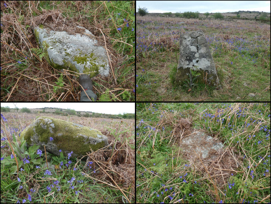
Photo taken on 06-05-2026
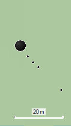
GPS Plan 06/05/2026
Database entries
OS Map: SX 74022 79974
OS Source: HER
HER: MDV130870
Alternate name: Hayne Down
Short Name: SR Hayne Down
Exist: Yes
Record: Unique
Record Source: HER
Hut Class: No
Lidar: SX 74022 79974
Guide Map: 30
Nearest Bus Stop (Minor): Swallerton Gate (1.2 km) [Route: 271]
Nearest Bus Stop (Major): Lustleigh Bishops Stone (4.8 km) [Route: 178]
Nearby sites: SX 74022 79974
Notes
Cunis, E, 2021, (HER Correspondence). (04/03/2021) Possible cairn(s) and small stone row identified on Hayne Down. William Crossing mentions a cist 'near the southern group of summit rocks’ (reported by Butler in Vol. One) but cairn not mentioned therefore this may be a separate feature.One stone standing prominently, another 2-3 noted in a linear arrangement from what looks like a round cairn at the north-western end. Grid Ref: SX74022 79974.
The author located this feature with Steve Szypko on 06/05/2026. We found 3 stones aligned on what appears to be a disturbed cairn. Further away is a fourth stone on the same alignment. We carried out a GPS survey using a Garmin device.
Cairn: SX 74025 79969
Stone 1: SX 74029 79964
Stone 2: SX 74031 79962
Stone 3: SX 74034 79960
Stone 4: SX 74044 79950
In our view this is a very plausible stone row. It was formerly listed here as a reported stone row. This has now been changed to stone row.
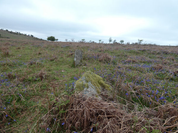
Photo 06/05/26 looking NW along the row
The photo montage above shows the individual stones of the row. Stone 2, still standing, and the cairn are below.
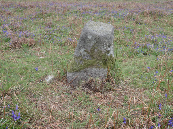
Photo 06/05/26 Stone 2

Photo 06/05/26 The cairn has been an animal hole in it - possibly sign of loser soil of a cairn.
NB. This is very unlikely to be the feature mentioned by Crossing. The current entry for that is located between the two tors and is nearly half a kilometre away. See: Hayne Down summit Reported Cist