
Rippon Tor Cairn
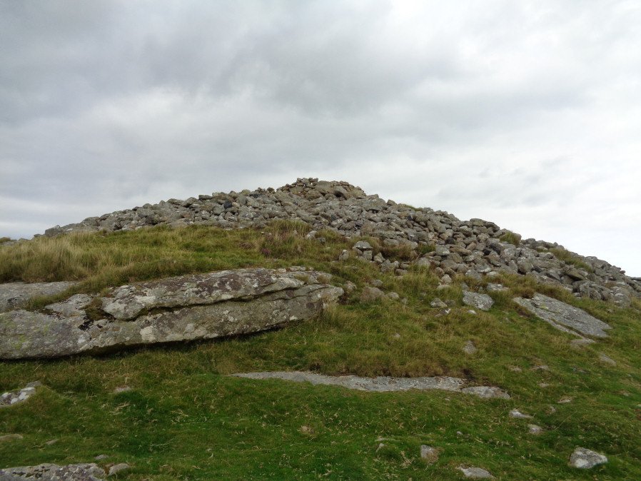
Photo taken on 26-08-2017
Database entries
OS Map: SX 74664 75581
OS Source: Google
Butler OS: SX74687556
HER: MDV7539
Megalithic Portal: 17833
PMD: Rippon Tor Summit
Alternate name: Rippon Tor 1
Short Name: CN RipponTor 1
Butler map: 5.5.1
Grinsell: ILSINGTON 1
Exist: Yes
Record: Unique
Record Source: Butler
Hut Class: No
Cairn Class: Yes
Dimensions (m): 28.0 x 4.0
Lidar: SX 74664 75581
Guide Map: 37
Nearest Bus Stop (Minor): Haytor Vale Moorlands House (3.5 km) [Route: 193,271]
Nearest Bus Stop (Major): Lemonford Caravan Park (5.7 km) [Route: 38,193]
Nearby sites: SX 74664 75581
Notes
HER: A massive cairn on the summit of Rippon Tor, 28 metres in diameter and 4 metres high. One of four cairns in the vicinity. It is an approximately circular mound of granite boulders, with an overall spread of 27 metres. The top has been much altered and added to, and the central area hollowed; there is also the more recent addition of an Ordnance Survey trig pillar within the hollow. Condition is declining due to frequent interference by the public.NB. Formerly listed as a ring cairn which was a mistake now corrected.
References
These are selected references with an emphasis on out of copyright sources linked as PDFs. For more detailed references try any linked HER or PMD record above.
- Butler, Jeremy, Dartmoor Atlas of Antiquities, vol.1: The East, (1991)
- Crossing, William, Guide to Dartmoor, (2001)
- Grinsell, L.V., Dartmoor Barrows, Devon Archaeological Society Proceedings No.36 (1978)
- Newman, Phil, Rippon Tor Premier Archaeological Landscape, Dartmoor National Park, Devon, Southwest Landscape Investigations (2015)
- Rowe, Samuel, A Perambulation of Dartmoor (3rd Edition), (1896)
- Wall, J. Charles, Ancient Earthworks, The Victoria History of the County of Devon: v. 1 pp.573-630 (1906)