
Berry Pound
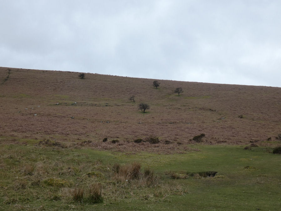
Photo taken on 01-04-2026
The upper bank has slipped downhill (photo 01/04/2026).
Database entries
OS Map: SX 71325 80349
OS Source: Google
HER: MDV8754
Alternate name: Berry
Short Name: PD:Berry
Butler map: 20.3
Exist: Yes
Record: Unique
Record Source: PDW
Hut Class: No
Lidar: SX 71325 80349
Guide Map: 29
Nearest Bus Stop (Minor): Swallerton Gate (3.8 km) [Route: 271]
Nearest Bus Stop (Major): Postbridge Bellever (6.5 km) [Route: 98]
Nearby sites: SX 71325 80349
Notes
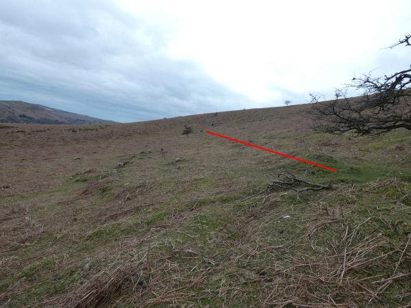
Butler (1991): Prehistoric pound clinging to the steep hillside beside the East Webburn river. Its was included within later enclosures on the east side of the down. All traces of huts, which were almost certainly present, have been cleared from within and the marks of the plough can be clearly seen scoring the interior. The site was exceptionally steep for a pound and stones from the inner wall uphill have slid down the slope in a confused tumble with only the largest remaining in place. The Medieval ridge and furrow in the outer field run right up to the walls of a small longhouse to the east. Other details: Map 20, Site 3, Figure 20.3.Butler (1997 p.20) states that Berry Pound, being on a 13 degree slope, is an example where large movements due to solifluction have taken place.
Gerrard (1997 p.51) categorises Berry Pound as a settlement of Type E which is an enclosure only. An enclosure that was only ever intended to hold lifestock, or enclosed timber buildings or stone buildings which have since been robbed out leaving no trace.
The author visited the site with Steve Szypko on 01/04/2026. The second photo here shows the upepr circuit of the pound marked in red and to the left in the photo can be seen a lot of material that has slipped down the slope as reported by Butler.
References
These are selected references with an emphasis on out of copyright sources linked as PDFs. For more detailed references try any linked HER or PMD record above.
- Butler, Jeremy, Dartmoor Atlas of Antiquities, vol.1: The East, (1991)
- Butler, Jeremy, Dartmoor Atlas of Antiquities, vol.5: The Second Millennium B.C., (1997)
- Gerrard, Sandy, English Heritage Book of Dartmoor: Landscapes Through Time, (1997)