
Guide to the Monuments on Great Nodden
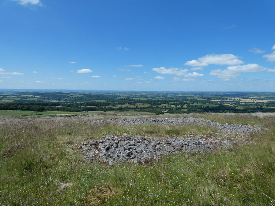
Table of Ritual and Burial Monuments on Great Nodden
The following table lists the records currently in this Guide Map. For an explantion of the Guide Maps and a table of all 62 Guide Maps, follow this link: Guide List Table. Introductory text will be added to each guide list in 2025. Notes on duplication and omissions will appear below the table once checks have been finalised.
| Guide # | Butler | SiteID | Site Name | ShortName | Record Source | Map | Turner | HER | Photo | Unique? | Checked |
|---|---|---|---|---|---|---|---|---|---|---|---|
| 1 | 1351 | Great Nodden M Cairnfield Master | CN:Great Nod M | Butler | SX5346086990 | MDV14524 | N | Duplicate | 1 | ||
| 2 | 43.7.1 | 1335 | Great Nodden 1 Cairn Circle | CN Great Nod 1 | Butler | SX5307986222 | MDV134871 | Y | Unique | 1 | |
| 3 | 43.7.2 | 1336 | Great Nodden 2 Cairn | CN Great Nod 2 | Butler | SX5310186256 | MDV134874 | Y | Unique | 1 | |
| 4 | 43.7.3 | 1337 | Great Nodden 3 Cairn | CN Great Nod 3 | Butler | SX5307886287 | MDV134875 | Y | Unique | 1 | |
| 5 | 43.7.4 | 1338 | Great Nodden 4 Cairn | CN Great Nod 4 | Butler | SX5324986629 | MDV51450 | Y | Unique | 1 | |
| 6 | 43.7.5 | 1339 | Great Nodden 5 Cairn | CN Great Nod 5 | Butler | SX5334386810 | MDV51448 | Y | Unique | 1 | |
| 7 | 43.7.6 | 1340 | Great Nodden 6 Cairn | CN Great Nod 6 | Butler | SX5334086820 | MDV51449 | Y | Unique | 1 | |
| 8 | 43.7.7 | 1341 | Great Nodden 7 Cairn | CN Great Nod 7 | Butler | SX5333786887 | MDV51447 | Y | Unique | 1 | |
| 9 | 43.7.8 | 1342 | Great Nodden 8 Cairn | CN:Great Nod 8 | Butler | SX5339086890 | MDV51446 | N | Unique | 1 | |
| 10 | 43.7.9 | 1343 | Great Nodden 9 Cairn | CN:Great Nod 9 | Butler | SX5340086910 | MDV51507 | N | Unique | 1 | |
| 11 | 43.7.10 | 1344 | Great Nodden 10 Cairn | CN Great Nod10 | Butler | SX5337086934 | MDV51445 | Y | Unique | 1 | |
| 12 | 43.7.11 | 1345 | Great Nodden 11 Cairn | CN Great Nod11 | Butler | SX5347787054 | MDV51505 | Y | Unique | 1 | |
| 13 | 43.7.12 | 1346 | Great Nodden 12 Cairn | CN Great Nod12 | Butler | SX5344587077 | MDV131782 | Y | Unique | 1 | |
| 14 | 43.7.13 | 1347 | Great Nodden 13 Cairn | CN Great Nod13 | Butler | SX5362087409 | MDV4676 | Y | Unique | 1 | |
| 15 | 43.7.14 | 1348 | Great Nodden 14 Reported Cairn | CN-Great Nod14 | Butler | SX5369587564 | MDV55724 | Y | Unique | 1 | |
| 16 | 43.7.15 | 1349 | Great Nodden 15 Cairn | CN Great Nod15 | Butler | SX5422587874 | MDV12847 | Y | Unique | 1 | |
| 17 | 43.7.16 | 1350 | Great Nodden 16 Cairn | CN Great Nod16 | Butler | SX5388787421 | MDV4625 | Y | Unique | 1 | |
| 18 | 43.7.17 | 440 | Great Nodden 17 Cist | CT Great Nod17 | Butler | SX5388087410 | MDV4625 | Y | Unique | 1 | |
| 19 | 43.7.18 | 1352 | Great Nodden 18 Crop Mark | CN?Great Nod18 | Butler | SX5345087230 | MDV134902 | N | Unique | 1 | |
| 20 | 43.7.19 | 1353 | Great Nodden 19 Crop Mark | CN?Great Nod19 | Butler | SX5341087130 | MDV134902 | N | Unique | 1 | |
| 21 | 4164 | Great Nodden 20 Cairn | CN Great Nod20 | HER | SX5386087842 | n/a | Y | Unique | 1 | ||
| 22 | 194 | Little Links Tor Stone Row | SR LittleLinks | PMD | SX5423487486 | MDV51434 | Y | Unique | 1 | ||
| 23 | 1354 | Little Links Tor 1 Cairn | CN:LittleLink1 | HER | SX5428087470 | MDV51428 | N | Unique | 1 | ||
| 24 | 1367 | Little Links Tor 2 Cairn | CN:LittleLink2 | HER | SX5429187520 | MDV125847 | N | Unique | 1 | ||
| 25 | 43.13 | 663 | Great Links Tor Cairn | CN:GreatLinks | Butler | SX5492286496 | MDV4653 | N | Unique | 1 |
Notes on possible duplications and omissions
Great Nodden 8 and 9 These records originate with Butler. The HER says they are part of a group of 6 cairns. Not found on 03/06/22, 20/06/22, 28/04/23, 31/01/25. The other 4 can be located. However, this is terrain overgrown with many clumps of gorse looking like mounds. The NGRs for these 6 were often very inccurate in the original listings.Great Nodden 18 and 19 Butler two more only show up only in aerial photgraphs. It is right these have an HER entry. However, I have looked several times for any trace of cairns in these locations and I'm unable to find anything. Perhaps they are duplicates of two of the ring cairns among cairns 1-10 although Butler clearly thought not.
Great Nodden 20 This record formerly linked to HER record MDV55724 but that is now Cairn 14 which is not far away. This is a different large feature and seems not to match any entries on the HER. There are industrial workings in the vicinity so the origin of this is uncertain. It is on a quite overgrown slope and easier to approach from the northern side, the other side is almost impassable. Not sure whether this is suitable for the HER or not as I do not know what it is. It is certainly not Cairn 14 as I visited that and photographed it nearby on the same day.
PS. These notes are to assist untangling complicated records and are neither permanent nor a criticism of the HER who do a fantastic job! The author finds it easier to systematically work through these records (2000+ of them) and add these notes, which are then to be communicated with the HER, if appropriate, it is a pragmatic way of dealing with lots of data without continually stopping and starting.
Great Nodden Guide Map
Guidance for walkers: The monuments featured in this database are archaeological treasures and need to be protected and preserved - please do not disturb any sites. Please check access and firing times before visiting sites, not all sites listed are on open access land. Firing ranges and boundaries of open access areas are marked on the OL28 OS Dartmoor Explorer map. Please stick to the country code and consider giving support to the numerous agencies that help to keep Dartmoor a fabulous natural and historic environment!
List of Ritual and Burial Monuments on Great Nodden
Great Nodden M Cairnfield Master
OS Map: SX 53460 86990
HER record: MDV14524
ShortName: CN:Great Nod M
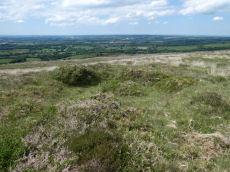
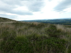
Notes: HER referring to Butler:Cemetery comprising sixteen battered cairns along the spur to the south of Great Nodden. Another cairn was recorded on the summit in 1891 and two more show up only as crop marks bringing the total to 19 cairns. Those that survive are composed of small stones and all of them lie in a prominent position on the western slopes or on the summit of the ridge. A number have the appearance of ring cairns, a circular bank around a flat interior, but some were probably cairns of normal shape from which all the interior stones have been carted away.
This is a master record and as such marked as a duplicate, see individual records for details.
Nearby sites: SX53468699
Great Nodden 1 Cairn Circle
OS Map: SX 53079 86222
HER record: MDV134871
ShortName: CN Great Nod 1
Butler map: 43.7.1
Notes: This site originates with Butler. A mound can be seen on Lidar imagery at SX 53077 86213 which matches the location given by Butler. Visited 3 June 2022 and there is clearly a substantial but badly damaged cairn at this location. It can also be seen on Google satellite imagery.
Nearby sites: SX53088622
Great Nodden 2 Cairn
OS Map: SX 53101 86256
HER record: MDV134874
ShortName: CN Great Nod 2
Butler map: 43.7.2
Notes: A mound can be seen on Lidar imagery at SX 53098 86249 which matches the location given by Butler. Butler: "two smaller and much pitted cairns 5 and 6 m across lie close to the field wall." Visited 3 June 2022. It looks a genuine site to the author. NGR and photo updated after visit 28 April 2023.
Nearby sites: SX53108626
Great Nodden 3 Cairn
OS Map: SX 53078 86287
HER record: MDV134875
ShortName: CN Great Nod 3
Butler map: 43.7.3
Notes: A mound can be seen on Lidar imagery at SX 53073 86276 which matches the location given by Butler. Butler: "two smaller and much pitted cairns 5 and 6 m across lie close to the field wall".
Nearby sites: SX53088629
Great Nodden 4 Cairn
OS Map: SX 53249 86629
HER record: MDV51450
ShortName: CN Great Nod 4
Butler map: 43.7.4
Notes: Ring cairn. "Earthwork survives as a circular bank, 2.3m wide and 0.3m high surrounding an internal area measuring 13.4m in diameter. A mound measuring 6m in diam and 0.2m high stands in the centre of the area enclosed by the circular bank (mpp)". The grid reference given by Butler is a rare mistake. The Butler 43 map and the description make it clear the site is actually located in the vicinity of SX 5324 8660 which is around 400m north the grid reference given on p.245. This corrected grid reference corresponds with the cairn listed here. Visit on 20/06/22 resulted in the photo used. Follow up visit 28/04/23 - found again with difficulty despite having correct grid reference. Not easy to see in the vegetation but it is clearly there and for that reason the entry has been changed from reported cairn to cairn.
Nearby sites: SX53258663
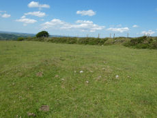
Great Nodden 5 Cairn
OS Map: SX 53343 86810
HER record: MDV51448
ShortName: CN Great Nod 5
Butler map: 43.7.5
Notes: Group of 6 small cairns. This clear mound is not far from Great Nodden 6. NGR from Garmin reading taken 28/04/23. "One of two Bronze Age round cairns south-west of Great Nodden. Cairn mound is flat-topped, measures 5m in diameter and stands up to 0.6m high"
Nearby sites: SX53348681
Great Nodden 6 Cairn
OS Map: SX 53340 86820
HER record: MDV51449
ShortName: CN Great Nod 6
Butler map: 43.7.6
Notes: Group of 6 small cairns. These 6 small cairns are quite difficult to find in the undergrowth especially when original NGRs were inaccurate. Visited 03/06/22 and 28/04/23. NGR has been updated with an accurate Garmin reading. Very clear mound for this cairn.
Nearby sites: SX53348682
Great Nodden 7 Cairn
OS Map: SX 53337 86887
HER record: MDV51447
ShortName: CN Great Nod 7
Butler map: 43.7.7
Notes: Group of 6 small cairns. Visited on 03/06/22 and 28/04/23. NGR and details confirmed on 28/04/23.
Nearby sites: SX53348689
Great Nodden 8 Cairn
OS Map: SX 53390 86890
HER record: MDV51446
ShortName: CN:Great Nod 8
Butler map: 43.7.8
Notes: Group of 6 small cairns. Not found on 03/06/22, 20/06/22, 28/04/23, 31/01/25. However, this is overgrown terrain with many clumps of vegetation looking like mounds. The NGRs for these 6 were often very inccurate in the original listings.
Nearby sites: SX53398689
Great Nodden 9 Cairn
OS Map: SX 53400 86910
HER record: MDV51507
ShortName: CN:Great Nod 9
Butler map: 43.7.9
Notes: Group of 6 small cairns. Not found on 03/06/22, 20/06/22, 28/04/23, 31/01/25. However, this is overgrown terrain with many clumps of vegetation looking like mounds. The NGRs for these 6 were often very inccurate in the original listings.
Nearby sites: SX53408691
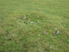
Great Nodden 10 Cairn
OS Map: SX 53370 86934
HER record: MDV51445
ShortName: CN Great Nod10
Butler map: 43.7.10
Notes: Group of 6 small cairns. Visited 03/06/22 and again 28/04/23. "Round cairn. Mound measures 6m in diameter and stands up to 0.6m high. A 1.4m square stone filled hollow in the centre of the mound suggests partial early excavation or robbing."
Nearby sites: SX53378693
Great Nodden 11 Cairn
OS Map: SX 53477 87054
HER record: MDV51505
ShortName: CN Great Nod11
Butler map: 43.7.11
Notes: Ring cairn. Earthwork survives as a circular bank, 3.5m wide and 0.5m high surrounding an internal area measuring 10.7m in diameter. A 2.5m wide gap in the w side of the bank may represent an original entrance. Interior of this cairn is pitted with hollows, which suggest partial robbing or early excavation. Visited 3 June 2022.
Nearby sites: SX53488705
Great Nodden 12 Cairn
OS Map: SX 53445 87077
HER record: MDV131782
ShortName: CN Great Nod12
Butler map: 43.7.12
Notes: Butler: "a circular bank 9 m across surrounds a pit with a floor well below ground level". On the western side of the path, near the larger ring cairn that is located on the eastern side.
This record previously linked to the enclosure MDV27341. That feature could be one and the same as this cairn.
Nearby sites: SX53458708
Great Nodden 13 Cairn
OS Map: SX 53620 87409
HER record: MDV4676
ShortName: CN Great Nod13
Butler map: 43.7.13
Grinsell: BRI 6
Notes: "Cairn mound measures 17.3m in diameter and stands up to 1m high. Loose rubble covering the centre of the mound suggests that the cairn has been partially excavated or robbed." Visited 3 & 20 June 2022.
Nearby sites: SX53628741
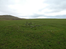
Great Nodden 14 Reported Cairn
OS Map: SX 53695 87564
HER record: MDV55724
ShortName: CN-Great Nod14
Butler map: 43.7.14
Notes: Butler: "The pit with a surrounding bank is also probably the remains of a robbed cairn". Visited 3 June 2022 ans 28/04/23. Butler suggests this pit is probably part of bronze age cairn. He could be right. Lake Viaduct can be seen from this location. A few hundred metres to the north on Lake Down there are some pits which are gun dug-outs overlooking the then railway over the viaduct. This pit doesn't look so modern and regular but it is quite overgrown.
Nearby sites: SX53708756
Great Nodden 15 Cairn
OS Map: SX 54225 87874
HER record: MDV12847
ShortName: CN Great Nod15
Butler map: 43.7.15
Grinsell: BRI 5
Notes: "Cairn mound measures 11m north-east to south-west by 7m north-west to south-east and stands up to 0.5m high. Two narrow trenches cut into either end of the mound, represent partial early excavation or robbing. The north trench measures 3m by 1.2m by 0.2m deep, whilst the southern one is 2.5m by 1m wide by 0.1m deep." Visit 3 June 2022 on which I recorded a cist-shaped trench. The HER refers to trenches dug into this cairn.
Nearby sites: SX54238787
Great Nodden 16 Cairn
OS Map: SX 53887 87421
HER record: MDV4625
ShortName: CN Great Nod16
Butler map: 43.7.16
Grinsell: BRI 7
Notes: This is a badly damaged cairn 14m across.
Nearby sites: SX53898742
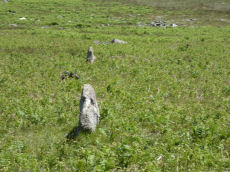
Great Nodden Cist
OS Map: SX 53880 87410
HER record: MDV4625
Megalithic Portal: 45796
PMD: Great Nodden
Alternate name: Great Nodden 17 Cist
ShortName: CT Great Nod17
Butler map: 43.7.17
Grinsell: BRI 7a
Barrow Report: 13 21
Notes: Butler: "recorded on the summit in 1891". This was excavated revealing a cist. No longer traceable. This cairn and cist was around 6m away from the Great Nodden cairn. The photograph accompanying this record is of the Great Nodden Cairn in the vicinity of where this cist used to exist. Butler Vol. 2. Map 43.7.17.
Nearby sites: SX53888741
Great Nodden 18 Crop Mark
OS Map: SX 53450 87230
HER record: MDV134902
ShortName: CN?Great Nod18
Butler map: 43.7.18
Notes: Butler. Two of the cairns "show up only as crop marks on aerial photographs". Visit 03/06/22, 20/06/22, 28/04/23 and 31/01/25 - unable to locate feature.
Nearby sites: SX53458723
Great Nodden 19 Crop Mark
OS Map: SX 53410 87130
HER record: MDV134902
ShortName: CN?Great Nod19
Butler map: 43.7.19
Notes: Butler. Two of the cairns "show up only as crop marks on aerial photographs". Visit 03/06/22, 20/06/22, 28/04/23 and 31/01/25 - unable to locate feature.
Nearby sites: SX53418713
Great Nodden 20 Cairn
OS Map: SX 53860 87842
HER: No record found
ShortName: CN Great Nod20
Notes: This record formerly linked to HER record MDV55724 but that is now Cairn 14 which is not far away. This is a different feature and seems not to match any entries on the HER. There are industrial workings in the vicinity so origin of this is uncertain. It is of significant size.
Nearby sites: SX53868784
Little Links Tor Stone Row
OS Map: SX 54234 87486
HER record: MDV51434
The Stone Rows of GB: Little Links Tor
PMD: Little Links Tor
ShortName: SR LittleLinks
Notes: Formerly listed at SX 54160 87470. Visited on 20 June 2022 and correct location is SX 54234 87486.
Nearby sites: SX54238749
Little Links Tor 1 Cairn
OS Map: SX 54280 87470
HER record: MDV51428
ShortName: CN:LittleLink1
Notes: HER: Ring cairn. Survives as a circular bank 2m wide and 0.4m high surrounding an internal area measuring 13m in diameter. A 3m wide gap in the western side of the bank may be the result of partial robbing. This ring cairn is of the unrevetted without central mound variety.
Nearby sites: SX54288747
Little Links Tor 2 Cairn
OS Map: SX 54291 87520
HER record: MDV125847
ShortName: CN:LittleLink2
Notes: HER quoting Greeves: Apparently unrecorded prehistoric cairn in the upper reaches of the River Lyd, approximately 150 metres north of the Smallacombe valley. Located at SX 54291 87520, approximately 30 metres north-west of ring cairn MDV51428. It is a low cairn mound with a relatively level top, no more than about 0.30 metres in height, approximately 10 metres by 9.0 metres in diameter.
It lies not far north of the stone alignment MDV51434, which due to the significant amount of prehistoric activity in this area, is likely to be a prehistoric stone row.
Nearby sites: SX54298752
Great Links Tor Cairn
OS Map: SX 54922 86496
HER record: MDV4653
Megalithic Portal: 10043
ShortName: CN:GreatLinks
Butler map: 43.13
Grinsell: BRI 8
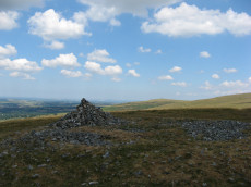
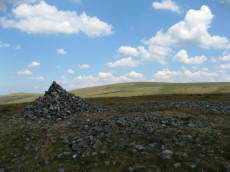
Notes: "cairn with hollow in centre. Diam 17.5m, height 1.6m. ... (grinsell) 18.0m diameter, 1.4m high. Siting - hillspur. ... (gerrard) cairn mound measures 19m in diameter and stands up to 1.5m high. An irregular shaped hollow in the centre of the mound, measuring 4m long, 3m wide and up to 1.3m deep, suggests partial early excavation or robbing (mpp)."
Nearby sites: SX54928650
Page last updated 10/12/24