
Rippon Tor 5 Cairn
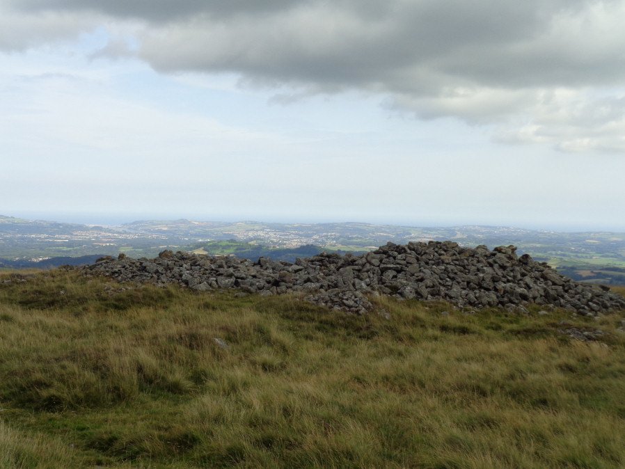
Photo taken on 26-08-2017
Database entries
OS Map: SX 74750 75479
OS Source: Google
Butler OS: SX74787545
HER: MDV7433
Alternate name: Rippon Tor 5
Short Name: CN RipponTor 5
Butler map: 5.5.5
Grinsell: ILSINGTON 4
Exist: Yes
Record: Unique
Record Source: Butler
Hut Class: No
Cairn Class: Yes
Dimensions (m): 20.0 x 2.0
Lidar: SX 74750 75479
Guide Map: 37
Nearest Bus Stop (Minor): Haytor Vale Moorlands House (3.5 km) [Route: 193,271]
Nearest Bus Stop (Major): Lemonford Caravan Park (5.5 km) [Route: 38,193]
Nearby sites: SX 74750 75479
Notes
HER: One of a pair of large cairns south-east of Rippon Tor. It is located on a reave but probably predates it. A much spread and turf-covered cairn of up to 25 metres diameter, 87 metres south-east of Rippon Tor outcrop.References
These are selected references with an emphasis on out of copyright sources linked as PDFs. For more detailed references try any linked HER or PMD record above.
- Butler, Jeremy, Dartmoor Atlas of Antiquities, vol.1: The East, (1991)
- Crossing, William, Guide to Dartmoor, (2001)
- Grinsell, L.V., Dartmoor Barrows, Devon Archaeological Society Proceedings No.36 (1978)
- Newman, Phil, Rippon Tor Premier Archaeological Landscape, Dartmoor National Park, Devon, Southwest Landscape Investigations (2015)
- Wall, J. Charles, Ancient Earthworks, The Victoria History of the County of Devon: v. 1 pp.573-630 (1906)