
Hurston Ridge Stone Row Cairn
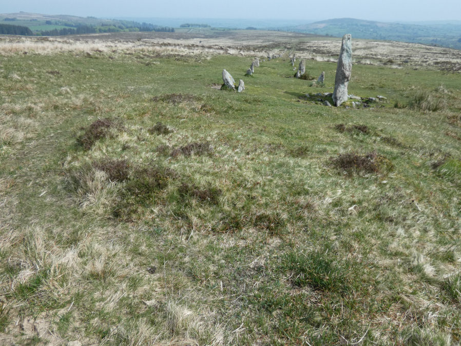
Photo taken on 10-05-2024
Database entries
OS Map: SX 67266 82438
OS Source: Garmin
HER: MDV61939
PMD: Hurston Ridge Stone Row
Alternate name: Hurston Ridge Stone Row
Short Name: CN Hurston R6
Butler map: 25.9
Butler Vol 5: p.221 & Fig.154
Grinsell: CHAGFORD 5
Exist: Yes
Record: Unique
Record Source: Butler
Cist Class: Maybe
Cairn Class: Yes
Dimensions (m): 6.5/7.0 x 0.5 C
Lidar: SX 67266 82438
Nearest Bus Stop: Warren House Inn (1.5 km) [Route: 171]
Nearby sites: SX 67266 82438
Notes
The cairn at the upper end of the alignment measures 5.9 metres in diameter and stands up to a height of 0.6 metres. A large slab denoting the north eastern edge of the cairn may represent a second blocking stone of the associated alignment. A cinerary urn was found in the cairn. "The cairn has been throughly rifled ... It's shape is irregular ... but with no sign of the cist at one time visible here" (Butler Vol 2 p.30).References
These are selected references with an emphasis on out of copyright sources linked as PDFs. For more detailed references try any linked HER or PMD record above.
- Butler, Jeremy, Dartmoor Atlas of Antiquities, vol.2: The North, (1991)
- Butler, Jeremy, Dartmoor Atlas of Antiquities, vol.5: The Second Millennium B.C., (1997)
- Grinsell, L.V., Dartmoor Barrows, Devon Archaeological Society Proceedings No.36 (1978)