
White Tor Summit Cairn
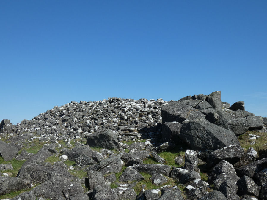
Photo taken on 27-05-2022
Database entries
OS Map: SX 54220 78638
OS Source: Google
HER: MDV4147
Alternate name: White Tor Summit
Short Name: CN WhiteTorSum
Butler map: 31.13
Grinsell: PETER TAVY 22
Exist: Yes
Record: Unique
Record Source: Butler
Cairn Class: Yes
Dimensions (m): 27.0 x 3.5
Lidar: SX 54220 78638
Nearest Bus Stop: Merrivale Dartmoor Inn (3.5 km) [Route: 98,171,172]
Nearby sites: SX 54220 78638
Notes
"Cairn in white tor camp. Large cairn in sw portion of the camp. Many hundreds of cartloads of stones are here lying piled up like a cairn against one of the rock outcrops on the summit. The stones are all of handy size, none of them are built in, but thrown together pell mell. On the top of the cairn are two cavities, which seem to have been made by previous explorers. All the stones were removed from the cairn following the contour of rock to a distance of 7.32m, with a width of 3.05m and a depth of 2.75m. The surface of the ground thus exposed, was dug into until the cairn was reached and the only reward obtained after this heavy work consisted of a couple of small flint flakes. No charcoal was seen and nothing to indicate the use of this great heap of stones. It does not seem to be sepulchral nor could it have been used as a beacon, for in the former, some trace of interment would have been disclosed, and in the latter charcoal and signs of fire. May have been a look- out place or stones for ammunition only a large cairn here now, with hollow in centre (baring-gould)."References
These are selected references with an emphasis on out of copyright sources linked as PDFs. For more detailed references try any linked HER or PMD record above.
- Baring-Gould, Sabine, Sixth Report of the Dartmoor Exploration Committee, T.D.A. Vol.31 pp.146-155 (1899)
- Butler, Jeremy, Dartmoor Atlas of Antiquities, vol.2: The North, (1991)
- Grinsell, L.V., Dartmoor Barrows, Devon Archaeological Society Proceedings No.36 (1978)
- Newman, Phil, Archaeological Sites within Merrivale Training Area, Southwest Landscape Investigations (2018)