
Black Tor (Stanlake) Stone Row
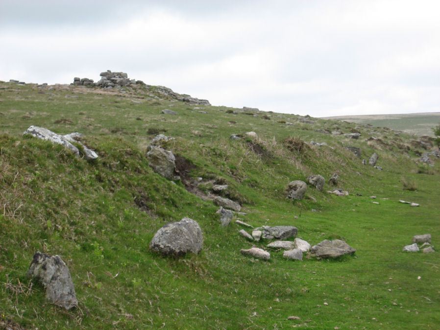
Photo taken on 25-05-2015
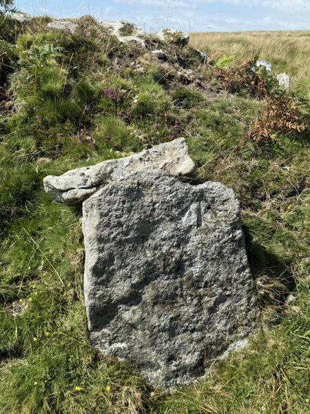
Stone with benchmark in top right corner (SX 57151 71508). Photo courtesy of Emma Cunis. 11/08/2025
Database entries
PDW coverage: Dartmoor Walk: Sharpitor area Stone Rows and Cists
OS Map: SX 56988 71381
OS Source: SRGB
HER: MDV4994
Megalithic Portal: 1771
The Stone Rows of GB: Black Tor Stanlake
PMD: Black Tor Stanlake Stone Row
Alternate name: Black Tor (Stanlake)
Short Name: SR Stanlake
Butler map: 45.14
DPD page: 24
Exist: Yes
Record: Unique
Record Source: PDW
Hut Class: No
Dimensions (m): 295
Lidar: SX 56988 71381
Guide Map: 38
Nearest Bus Stop: Princetown Dartmoor Visitor Centre (3.9 km) [Route: 98,171,172]
Nearby sites: SX 56988 71381
Notes
"A Bronze Age Stone Row lies just inside, and is partly buried by, a substantial field boundary. The row extends from SX57217155 to SX57007137, some 294m long and includes at least 57 visible stones. Its north-eastern end is denoted by a substantial blocking stone and its lower south-western end by three funerary cairns. The row can be seen as three distinct parts forming the whole. The northern part includes 39 stones, the central group of 8 stones is separated from the northern row by a 66.2m wide gap whilst the southern group is on a slightly different alignment to the others. The row is unusual in that the blocking stone is at the upper end and a cairn lies at the lower end." Lethbridge diagram and photo p.24.References
These are selected references with an emphasis on out of copyright sources linked as PDFs. For more detailed references try any linked HER or PMD record above.
- Butler, Jeremy, Dartmoor Atlas of Antiquities, vol.3: The South-West, (1994)
- Gerrard, Sandy, English Heritage Book of Dartmoor: Landscapes Through Time, (1997)
- Gerrard, Sandy, Stanlake prehistoric stone row, Meavy Valley Archaeology. Site Report No.4 (1997)
- Lethbridge, William D., Discover Preshistoric Dartmoor, (2015)
- Worth, R. Hansford, The Stone Rows of Dartmoor - Part 6, T.D.A. Vol.35 pp.426-29 (1903)
- Worth, R. Hansford, The Stone Rows of Dartmoor Part 1, T.D.A. Vol.78 pp.285-316 (1946)