
Sharpitor E. Stone Row
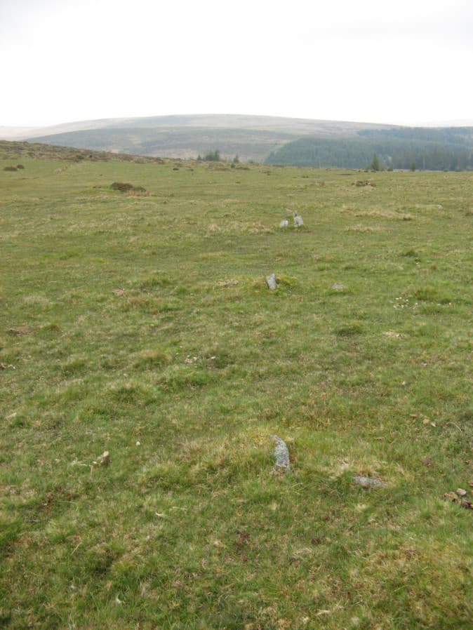
Photo taken on 17-05-2019
Database entries
PDW coverage: Dartmoor Walk: Sharpitor area Stone Rows and Cists
OS Map: SX 56171 70819
OS Source: Garmin
HER: MDV4991
Megalithic Portal: 2117
The Stone Rows of GB: Sharpitor North East
PMD: Sharpitor E Stone Row
Alternate name: Sharpitor NE
Short Name: SR Sharp NE
Butler map: 45.13
DPD page: 21
Exist: Yes
Record: Unique
Record Source: PDW
Hut Class: No
Dimensions (m): 27.5
Lidar: SX 56171 70819
Guide Map: 38
Nearest Bus Stop: Walkhampton Memorial (4.0 km) [Route: 55,56]
Nearby sites: SX 56171 70819
Notes
Described by Worth as "Sharpitor, foot of eastern slope". Listed by Butler as Sharpitor N.E. (which can be confused with another alleged row). "A stone row, with a cairn at the west end at SX 56147078, extends almost due west for 26.0m. to SX 56167078. The cairn, mutilated and amorphous, is now approximately 6.7m in diameter and 0.3m. high at its maximum. There are nine stones in the row, including three pairs, with an additional stone which seems to be displaced, all between 0.1m. and 0.3m. high. The east end of the row is terminated by a reave (SX 67 SE 91) which has cut across and evidently destroyed any westward extension." Lethbridge pp.20-22.References
These are selected references with an emphasis on out of copyright sources linked as PDFs. For more detailed references try any linked HER or PMD record above.
- Breton, Henry Hugh, Beautiful Dartmoor And Its Interesting Antiquities, (1990)
- Butler, Jeremy, Dartmoor Atlas of Antiquities, vol.3: The South-West, (1994)
- Emmett, D.D., Stone rows: the traditional view reconsidered, D.A.S.P. No.37 pp.94-114 (1979)
- Lethbridge, William D., Discover Preshistoric Dartmoor, (2015)
- Worth, R. Hansford, The Stone Rows of Dartmoor - Part 7, T.D.A. Vol.38 pp.535-37 (1906)
- Worth, R. Hansford, Barrow Report 42, T.D.A. Vol.55 pp.49-50 (1923)
- Worth, R. Hansford, The Stone Rows of Dartmoor Part 1, T.D.A. Vol.78 pp.285-316 (1946)