
Cosdon Hill N.3 Cist
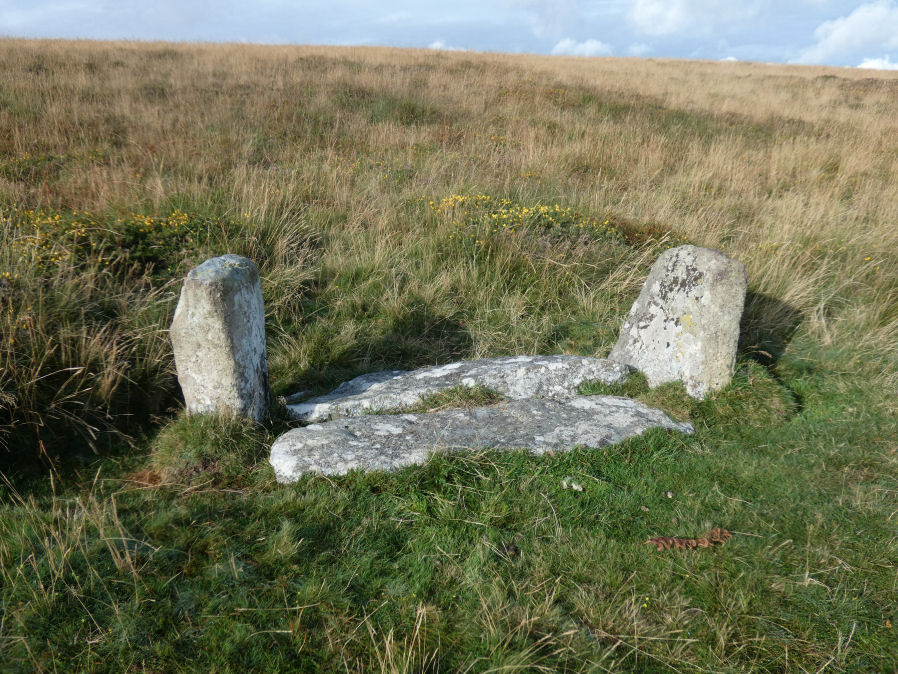
Photo taken on 12-09-2021
Database entries
OS Map: SX 63604 93067
OS Source: Google
Butler OS: SX63579306
HER: MDV6918
PMD: Skaigh
Alternate name: Cosdon Hill N.3
Short Name: CT Cosdon N3
Butler map: 40.8.3
Grinsell: SOUTH TAWTON 9
Exist: Yes
Record: Unique
Record Source: Butler
Hut Class: No
Cist Class: Yes
Cairn Class: Yes
Dimensions (m): 1.8 x 0.5 C
Lidar: SX 63604 93067
Guide Map: 3
Nearest Bus Stop: Sticklepath Devonshire Inn (1.4 km) [Route: 178,671,6A]
Nearby sites: SX 63604 93067
Notes
The remains of the cist, almost certainly that noted by Crawford, consist of two end stones 0.8 metres high and 0.5 metres wide, 1.8 metres apart and oriented north-west/ south-east. Between these uprights lie two fallen granite side-slabs, 1.5 metres long and 0.5 metres wide. "Butler believes these may be the remains of a well-known stone setting called the Eight Rocks which existed on the hillside here until sometime in the 19th century. This was probably the remaining circle of a cairn like the Nine Stones or Nine Maidens on Belstone Common (PRN6865), reputed to come alive and dance (Crossing, 1912)."See the entry for Eight Rocks for further discussion.
References
These are selected references with an emphasis on out of copyright sources linked as PDFs. For more detailed references try any linked HER or PMD record above.
- Butler, Jeremy, Dartmoor Atlas of Antiquities, vol.2: The North, (1991)
- Butler, Jeremy, Dartmoor Atlas of Antiquities, vol.5: The Second Millennium B.C., (1997)
- Crossing, William, Guide to Dartmoor, (2001)
- Grinsell, L.V., Dartmoor Barrows, Devon Archaeological Society Proceedings No.36 (1978)
- Hemery, Eric, High Dartmoor: Land and People, (1983)
- St Leger-Gordon, Douglas, Under Dartmoor hills, (1954)
- Worth, R.N., The Stone Rows of Dartmoor - Part 5, T.D.A. Vol.28 pp.712-13 (1896)