
Assycombe Stone Row
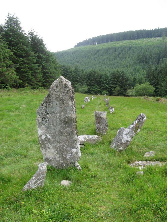
Photo taken on 01-07-2012
Database entries
PDW coverage: Dartmoor Site: Assycombe Double Stone Row
OS Map: SX 66095 82641
OS Source: SRGB
HER: MDV6537
Megalithic Portal: 1738
The Stone Rows of GB: Assycombe Stone Row
PMD: Assycombe Stone Row
Alternate name: Assycombe
Short Name: SR Assycombe
Butler map: 35.19
DPD page: 135
Exist: Yes
Record: Unique
Record Source: PDW
Hut Class: No
Dimensions (m): 125
Lidar: SX 66095 82641
Guide Map: 19
Nearest Bus Stop: Warren House Inn (2.9 km) [Route: 171]
Nearby sites: SX 66095 82641
Notes
"Bronze Age stone row and cairn, Assycombe. The double stone row is 120m long terminating in the cairn at the North-East end. The South-West end is blocked by a stone 2.0m high, re-erected there by Baring-Gould. The cairn is 8.4m in diameter and 0.6m high. Scheduled." Also from Burnard's 1892 field notes: The row, which starts from a ruined cairn, consists of 84 standing stones, and extends 800 feet E. and W., running in two rows down the hill towards Assycombe. It terminates towards the W. in a stone lying prone, 5' 9" long. 2'' wide. The avenue is from 5' to 6' wide, inner measurement. The stones composing the row are 18" high, and down to 6". Breton p.67-68.References
These are selected references with an emphasis on out of copyright sources linked as PDFs. For more detailed references try any linked HER or PMD record above.
- Brailsford, J. W, Bronze Age Stone Monuments of Dartmoor, Antiquity Volume 12, Number 48 pp.444-63 (1938)
- Breton, Henry Hugh, The Heart of Dartmoor, (1926)
- Butler, Jeremy, Dartmoor Atlas of Antiquities, vol.2: The North, (1991)
- Emmett, D.D., Stone rows: the traditional view reconsidered, D.A.S.P. No.37 pp.94-114 (1979)
- Gerrard, Sandy, English Heritage Book of Dartmoor: Landscapes Through Time, (1997)
- Lethbridge, William D., Discover Preshistoric Dartmoor, (2015)
- Newman, Phil, The Archaeology of Fernworthy Forest, Dartmoor, Southwest Landscape Investigations (2013)
- Worth, R. Hansford, The Stone Rows of Dartmoor Part 1, T.D.A. Vol.78 pp.285-316 (1946)
- Worth, R.N., The Stone Rows of Dartmoor - Part 1, T.D.A. Vol.24 pp.387-417 (1892)
- Worth, R.N., The Stone Rows of Dartmoor - Part 3, T.D.A. Vol.26 pp.296-307 (1894)