
White Ridge Stone Row
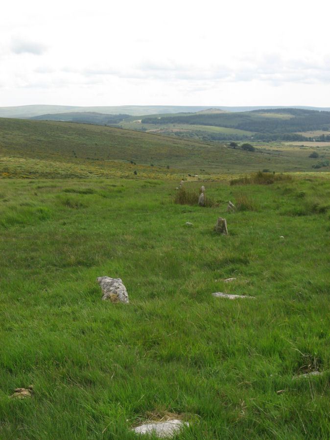
Photo taken on 03-08-2014

Photo 18/07/2025
Database entries
OS Map: SX 65420 81661
OS Source: SRGB
HER: MDV6642
Megalithic Portal: 4145
The Stone Rows of GB: White Ridge
PMD: White Ridge Stone Row
Alternate name: White Ridge
Short Name: SR White Ridge
Butler map: 35.20
DPD page: 125
Exist: Yes
Record: Unique
Record Source: PDW
Hut Class: No
Dimensions (m): 582
Lidar: SX 65420 81661
Guide Map: 27
Nearest Bus Stop: Warren House Inn (2.9 km) [Route: 171]
Nearby sites: SX 65420 81661
Notes
"A double stone row, 620 ft in length from the centre of a cairn at the north end, running nearly due south and slightly downhill. Well preserved at the north end for a short distance but becoming more dilapidated as it approaches the newtake wall at the south end". Lethbridge diagram p.124 and photo top p.125. Breton p.45 sadly robbed to build the wall, but the upper part is still a good specimen of the double avenue. It is 260 yds. long; there are three stones on the S. side of the wall.It is now thought this row continues the other side of the newtake wall and possibly leads to the Stannon Newtake row which is the terminal end. Remains beyond the wall are sparse but possibly exposed following vegetation clearance by the Dartmoor Preservation Association.
The author re-visited this site on 18/07/2025. The summer of 2025 at a similar time of year to 2014. The row seems to be far more overgrown by purple moor grass. Few of the 2014 stones can be seen today.
See also: Stannon Newtake Stone Row
References
These are selected references with an emphasis on out of copyright sources linked as PDFs. For more detailed references try any linked HER or PMD record above.
- Breton, Henry Hugh, The Heart of Dartmoor, (1926)
- Butler, Jeremy, Dartmoor Atlas of Antiquities, vol.2: The North, (1991)
- Emmett, D.D., Stone rows: the traditional view reconsidered, D.A.S.P. No.37 pp.94-114 (1979)
- Fleming, Andrew, The Prehistoric Landscape of Dartmoor Part 2: North and East Dartmoor , Proceedings of the Prehistoric Society , Volume 49 , Issue 1 , pp. 195 - 241 (1983)
- Worth, R. Hansford, The Stone Rows of Dartmoor Part 1, T.D.A. Vol.78 pp.285-316 (1946)