
Ranny Brook 22 Cairn
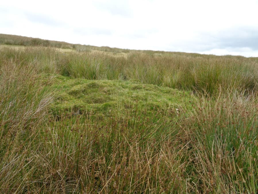
Photo taken on 25-08-2017
Database entries
OS Map: SX 6193 6343
OS Source: Constructed
Alternate name: Ranny Brook 22
Short Name: CN-Ranny Bro2
Butler map: 52.9
Exist: Yes
Record: Unique
Record Source: Butler
Hut Class: Yes
Cairn Class: Yes
Dimensions (m): 8.0 x 4.0 x 0.8
Lidar: SX 6193 6343
Nearest Bus Stop: Cornwood Crossways (4.1 km) [Route: 59]
Nearby sites: SX 6193 6343
Notes
A mound at SX 61940 63452 (Garmin GPS) is possibly the Ranny Brook 22 Cairn that Butler Map 52.9 refers to as a hut having been converted into a cairn. Butler gives SX 6193 6343 as the location - there are many huts in very close proximity in this area so certain identification is a bit tricky. The closest hut in the HER is 43759 which is thought to be located at SX 61956 63442 which is 19 metres from this mound. The site in the HER is supposedly 7.5 metres in diameter. So in terms of location this would almost be close enough to touch this mound - so maybe the grid references are slightly out and they are the same site. However, currently it would require a further visit to be certain. For now PDW sites 1590 and 7904 are being kept as separate unique records with their original OS grid references. If and when they are confirmed as the same site 1590 will be marked as a duplicate of 7904 and the details merged.References
These are selected references with an emphasis on out of copyright sources linked as PDFs. For more detailed references try any linked HER or PMD record above.
- Butler, Jeremy, Dartmoor Atlas of Antiquities, vol.3: The South-West, (1994)