
Butterdon Hill S.W.11 Cairn
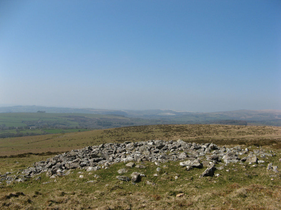
Photo taken on 30-03-2019
Database entries
OS Map: SX 65449 58602
OS Source: Google
Butler OS: SX65445859
HER: MDV3137
Alternate name: Butterdon Hill S.W.11
Short Name: CN Butterdon11
Butler map: 53.9.11
Grinsell: HARFORD 19
Exist: Yes
Record: Unique
Record Source: Butler
Hut Class: No
Cairn Class: Yes
Dimensions (m): 18.0 x 2.0
Lidar: SX 65449 58602
Guide Map: 58
Nearest Bus Stop: Ivybridge BP Garage (Stop B) (3.9 km) [Route: 38]
Nearby sites: SX 65449 58602
Notes
"Round cairn on butterdon hill ... situated on slope, in poor condition. Diameter 14.5m. Height varies 1.7m - 0.1m. ... Cairn covered by modern circular enclosure of granite boulders (included in height). Diameter 16m, height 1.8m."References
These are selected references with an emphasis on out of copyright sources linked as PDFs. For more detailed references try any linked HER or PMD record above.
- Butler, Jeremy, Dartmoor Atlas of Antiquities, vol.4: The South-East, (1993)
- Grinsell, L.V., Dartmoor Barrows, Devon Archaeological Society Proceedings No.36 (1978)