
Wetherdon Hill 18 Cairn
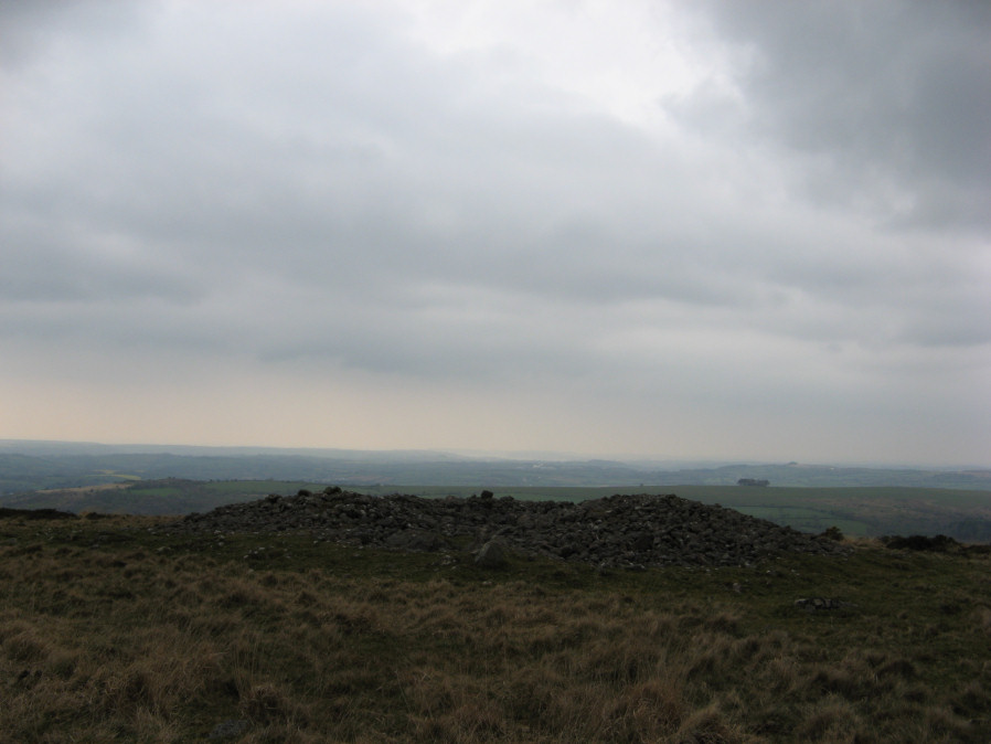
Photo taken on 13-04-2019
Database entries
OS Map: SX 65052 58863
OS Source: Google
Butler OS: SX65055885
HER: MDV3135
Alternate name: Wetherdon Hill 18
Short Name: CN Wetherdon18
Butler map: 53.9.18
Grinsell: HARFORD 13
Exist: Yes
Record: Unique
Record Source: Butler
Hut Class: No
Cairn Class: Yes
Dimensions (m): 20.0 x 1.5
Lidar: SX 65052 58863
Guide Map: 58
Nearest Bus Stop: Ivybridge BP Garage (Stop B) (4.0 km) [Route: 38]
Nearby sites: SX 65052 58863
Notes
"Large cairn consisting of a mound of loosely packed stones on a base of stone and earth, the circumference of which projects beyond the stones. It is 20m in diameter, 1.6m high and has an outer ditch"References
These are selected references with an emphasis on out of copyright sources linked as PDFs. For more detailed references try any linked HER or PMD record above.
- Butler, Jeremy, Dartmoor Atlas of Antiquities, vol.4: The South-East, (1993)
- Grinsell, L.V., Dartmoor Barrows, Devon Archaeological Society Proceedings No.36 (1978)