
Wild Tor Reported Cairn
Database entries
OS Map: SX 62218 87124
OS Source: Google
HER: MDV107564
Alternate name: Wild Tor
Short Name: CN-Wild Tor 3
Exist: Yes
Record: Unique
Record Source: Hemery
Hut Class: No
Lidar: SX 62218 87124
Guide Map: 11
Nearest Bus Stop (Minor): Wonson Telephone Box (7.4 km) [Route: 670]
Nearest Bus Stop (Major): Ramsley (6.6 km) [Route: 670,671,6A]
Nearby sites: SX 62218 87124
Notes
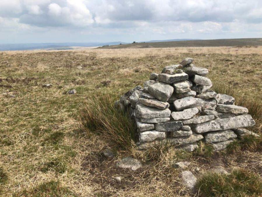
Photo by Steve Granger and reproduced here with his kind permission (copyright remains with Steve). This site is clearly not a prehistoric cairn but is of interest as a reported cairn. Eric Hemery in High Dartmoor (pp.824-5) states "approximately opposite the centre of the south 'bulb' of Bow Combe hour-glass, is a ruined cairn om a square base where a path branches right from the crest and descends the east flank of the ridge towards Gallavan Down. Not far from the cairn are the remains of two shelters, one circular, the other oval. The first may have been a shepherd's shelter, and the latter, the larger of the two a peat-cutter's house."The HER record 107564 reports the presence of many "mielner" platform's in this area and this could be the origins of this structure although most are considered to be round peat structures unlike this structure which has a square stone base. There was a peat charcoal industry in this area. The HER quotes Phil Newman: "The largest and clearest cluster of 'meiler' platforms on northern Dartmoor. At least 25 'meiler' platforms in an area completely denuded of peat. Located 737 metres south of Wild Tor. First recorded by Woolner in the 1960s. The existence of a peat charcoal industry on Dartmoor has its origins in the 12th century or earlier. Peat charcoal was used for iron smithing and tin smelting from the Medieval period until the 19th century. It provided a major income for Dartmoor residents. Large areas of suitable peat would have been harvested and dried before being burned to produce charcoal. The platforms onto which these 'meilers' were constructed are the only field evidence for the process. 'Meiler' platforms comprise raised, usually circular, earthworks with level tops. Although similar to peat drying platforms they lack the peripheral drainage ditch and charcoal samples confirm their use. The level platform was prepared with circular tiers of dried peat bricks with horizontal vents to admit a controlled air flow. Sites for peat charcoal burning were always on raised ground within areas of visible turf cutting and, on Dartmoor, between altitudes 465 metres and 545 metres OD. The cutting was often extensive and sometimes areas were denuded of peat. The platforms recorded so far are mostly organised in clusters at single locations suggesting that burning was undertaken at regional hubs." Note on grid reference: The HER gives SX 622 870 for the group of meilers - the grid reference used here is that of a squarish object that can be seen on Google satellite which is presumed to be the structure in the photo. See also Dartmoor Archive: Meiler near Wild Tor