
Stalldown South East Stone Row
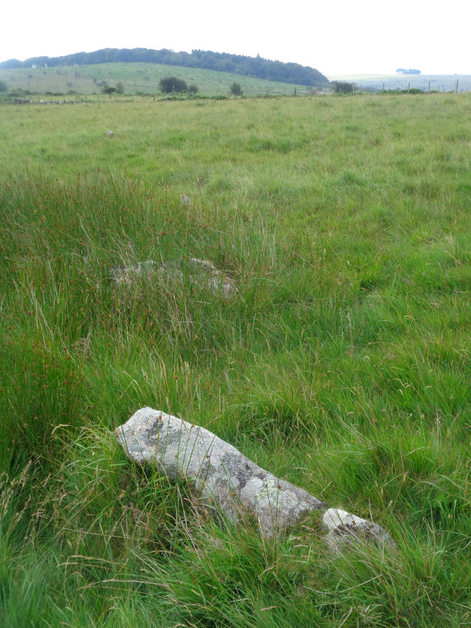
Photo taken on 16-07-2021
Database entries
OS Map: SX 63746 61059
OS Source: SRGB
The Stone Rows of GB: Stalldown South East
PMD: Stalldown SE1
Alternate name: Stalldown SE1
Short Name: SR StalldownSE
Butler map: 54.4
Exist: Yes
Record: Unique
Record Source: PMD
Hut Class: No
Dimensions (m): 21
Lidar: SX 63746 61059
Guide Map: 56
Nearest Bus Stop: Cornwood Crossways (4.7 km) [Route: 59]
Nearby sites: SX 63746 61059
Notes
The Stone Rows of Great Britain states: "This line of seven stones seems to be artificial and certainly looks like a stone row. The proximity of a number of small cairns further enhances this interpretation as does the visual relationship with Plymouth Sound. The stones however lies between two reaves (prehistoric boundary banks) and close to other boundaries. The possibility of this feature being an unfinished or partly robbed field boundary cannot therefore be wholly discounted." The author visited this site on 16/07/2021 and logged the location of 6 of the 7 stones of this row (must have missed one): SX 63748 61049, SX 63750 61056, SX 63751 61058, SX 63750 61060, SX 63751 61063, SX 63751 61065.References
These are selected references with an emphasis on out of copyright sources linked as PDFs. For more detailed references try any linked HER or PMD record above.
- Butler, Jeremy, Dartmoor Atlas of Antiquities, vol.4: The South-East, (1993)