
Harbourne Head B Embanked Cairn Circle
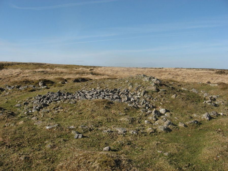
Photo taken on 25-03-2016
Database entries
OS Map: SX 69147 65009
OS Source: Garmin
Butler OS: SX69146500
HER: MDV5803
Megalithic Portal: 3279
Alternate name: Parnell's Hill 2
Short Name: CC Harbourne B
Butler map: 57.31.7
Grinsell: DEAN PRIOR 10
Turner: B12
Exist: Yes
Record: Unique
Record Source: Butler
Hut Class: No
Cairn Class: Yes
Dimensions (m): 23.0 x 1.5
Lidar: SX 69147 65009
Guide Map: 52
Nearest Bus Stop: South Brent Pool Park (6.8 km) [Route: 38]
Nearby sites: SX 69147 65009
Notes
"Embanked stone circle; annular bank of earth and/or stones with inner kerb of orthostats. Measures 15.0 metres in diameter internally with bank 2.0 metres wide and 0.5 meters high with a cairn in the centre, 9.0 metres in diameter and 1.1 metres in height. The west and south sides have been disturbed."References
These are selected references with an emphasis on out of copyright sources linked as PDFs. For more detailed references try any linked HER or PMD record above.
- Butler, Jeremy, Dartmoor Atlas of Antiquities, vol.4: The South-East, (1993)
- Crossing, William, Guide to Dartmoor, (2001)
- Grinsell, L.V., Dartmoor Barrows, Devon Archaeological Society Proceedings No.36 (1978)
- Turner, J.R., Ring Cairns, stone circles and related monuments on Dartmoor, D.A.S.P. No.48 pp.27-86 (1990)