
Brisworthy Stone Circle
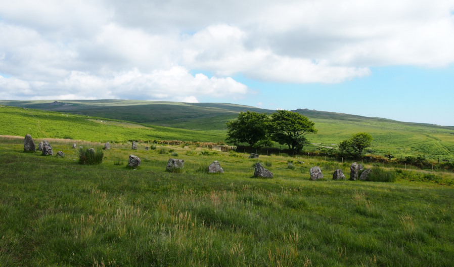
Photo taken on 16-07-2016
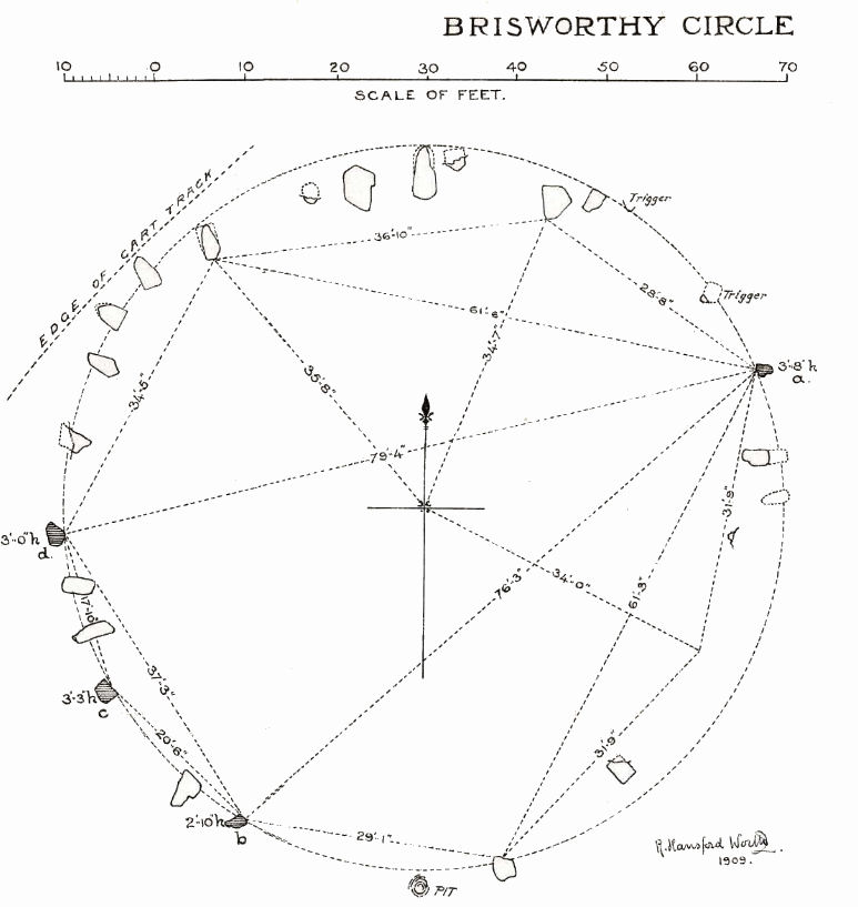
Plan by RHW. Barrow Report 35. 1909.
Database entries
PDW coverage: Dartmoor Site: Brisworthy Stone Circle
OS Map: SX 56467 65495
OS Source: Google
HER: MDV3983
Megalithic Portal: 542
PMD: Brisworthy Stone Circle
Alternate name: Brisworthy
Short Name: SC Brisworthy
Butler map: 49.18
Turner: G8
DPD page: 35
Exist: Yes
Record: Unique
Record Source: PDW
Hut Class: No
Cairn Class: Maybe
Barrow Report: 29 35
Dimensions (m): 24.0 x 27.0
Lidar: SX 56467 65495
Guide Map: 47
Nearest Bus Stop: Meavy Primary School (3.4 km) [Route: 56]
Nearby sites: SX 56467 65495
Notes
The Brisworthy circle underwent major reconstruction carried out by Breton and the Barrow Committee in 1909. At the time only 4 stones remained standing whilst another 21 were lying roughly in place. Some 15 stones out of 40 are missing, no doubt robbed for nearby enclosures and walls. A low rubble bank surrounds the circle which can be seen on LIDAR data. This is discussed in detail in the article 'Dartmoor Site: Brisworthy Stone Circle' linked above in this listing.Photo of restoration by R. H. Worth from Barrow Report 35.

See also: Legendary Dartmoor: Dartmoor's Brisworthy Circle. Lethbridge p.34-35. Diagram p.34 site 1.
References
These are selected references with an emphasis on out of copyright sources linked as PDFs. For more detailed references try any linked HER or PMD record above.
- Brailsford, J. W, Bronze Age Stone Monuments of Dartmoor, Antiquity Volume 12, Number 48 pp.444-63 (1938)
- Breton, Henry Hugh, Beautiful Dartmoor And Its Interesting Antiquities, (1990)
- Butler, Jeremy, Dartmoor Atlas of Antiquities, vol.3: The South-West, (1994)
- Gerrard, Sandy, English Heritage Book of Dartmoor: Landscapes Through Time, (1997)
- Lethbridge, William D., Discover Preshistoric Dartmoor, (2015)
- Lukis, W.C, Report on the Monuments of Dartmoor, Proceeding of the Society of Antiquaries Vol.8 (1881)
- Newman, Phil, Ringmoor Down Premier Archaeological Landscape - A new survey , Southwest Landscape Investigations (2022)
- Turner, J.R., Ring Cairns, stone circles and related monuments on Dartmoor, D.A.S.P. No.48 pp.27-86 (1990)
- Worth, R. Hansford, Barrow Report 29, T.D.A. Vol.42 pp.62-3 (1910)
- Worth, R. Hansford, Barrow Report 35, T.D.A. Vol.48 pp. (1916)
- Worth, R.N., The Stone Rows of Dartmoor - Part 4, T.D.A. Vol.27 pp.437-442 (1895)