
Down Ridge Stone Circle
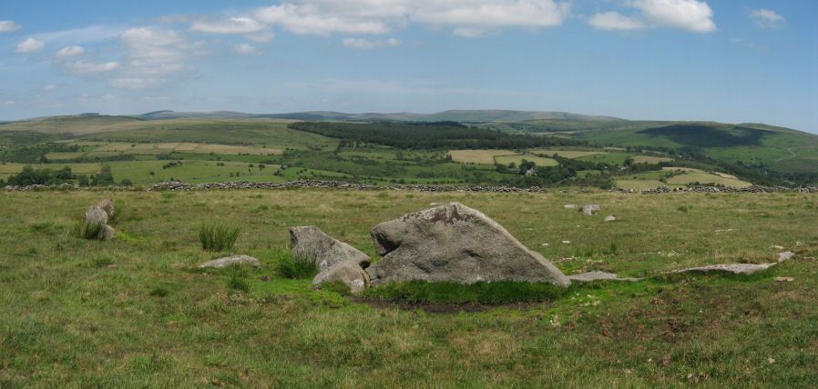
Photo taken on 22-07-2012
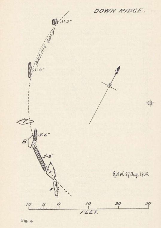
Plan by RHW. Two Stone Circles on Dartmoor. T.D.A. Vol.71. 1939.
Database entries
OS Map: SX 65516 72084
OS Source: Google
HER: MDV6400
Megalithic Portal: 863
PMD: Down Ridge Stone Circle
Alternate name: Down Ridge
Short Name: SC DownRidge
Turner: G9
DPD page: 92
Exist: Yes
Record: Unique
Record Source: PDW
Cairn Class: No
Dimensions (m): 25.0
Lidar: SX 65516 72084
Nearest Bus Stop: Dartmeet Badgers Holt (2.1 km) [Route: 172]
Nearby sites: SX 65516 72084
Notes
Also known as Hexworthy Circle. "situated on a gentle north facing slope overlooking the valley of the River Dart. The stone circle measures 25 meters in diameter and is denoted by five upright granite slabs, standing up to 1.45 meters high, which are confined to its south western sector. A further six recumbent stones lie where they have fallen. The stone circle was partially excavated in 1904 by the Dartmoor Exploration Committee and their work revealed the original ground surface covered with charcoal. An associated outlying standing stone is located 85 meters south-east of the stone circle and survives as a triangular shaped block up to 0.86 meters high." [HER MDV6400]. For photos of this site, see: Megalithic Portal: Down Ridge - Stone CircleReferences
These are selected references with an emphasis on out of copyright sources linked as PDFs. For more detailed references try any linked HER or PMD record above.
- Baring-Gould, Sabine, Tenth Report of the Dartmoor Exploration Committee, T.D.A. Vol.37 pp.141-145 (1905)
- Turner, J.R., Ring Cairns, stone circles and related monuments on Dartmoor, D.A.S.P. No.48 pp.27-86 (1990)
- Worth, R. Hansford, Two Stone Circles on Dartmoor, Swincombe Valley, and West Dart Valley, with a note on the Grey Wethers, T.D.A. Vol.71 pp.321-328 (1939)