
Drizzlecombe, North Cist
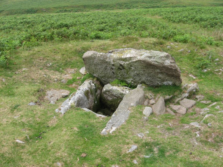
Photo taken on 31-07-2011
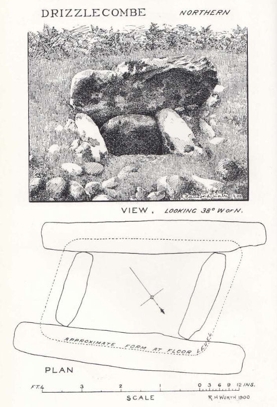
Plan by RHW. Barrow Report 19. TDA Vol.32 1900
Database entries
PDW coverage: Dartmoor Site: Drizzlecombe Ceremonial Complex (Photos 1)
OS Map: SX 59156 67215
OS Source: Garmin
Butler OS: SX59156721
HER: MDV3339
Megalithic Portal: 534
PMD: Drizzlecombe N 13
Alternate name: Drizzlecombe 13
Short Name: CT Drizzle 13
Butler map: 49.19.13
Dixon Cist #: 5
Grinsell: SHEEPSTOR 25
DPD page: 41
Exist: Yes
Record: Unique
Record Source: Butler
Hut Class: No
Cist Class: Yes
Cairn Class: Yes
Barrow Report: 19
Dimensions (m): 13.0 x 1.2 C
Lidar: SX 59156 67215
Guide Map: 48
Nearest Bus Stop: Meavy Primary School (6.1 km) [Route: 56]
Nearby sites: SX 59156 67215
Notes
Butler Drizzlecombe - Vol. 3. Map 49.19.13 (pp.135-142, general plan of Drizzlecombe complex p.135, diagram p.140 Cairn 13). Lethbridge p.38-41, diagram p.38 Cist B(2)References
These are selected references with an emphasis on out of copyright sources linked as PDFs. For more detailed references try any linked HER or PMD record above.
- Butler, Jeremy, Dartmoor Atlas of Antiquities, vol.3: The South-West, (1994)
- Gerrard, Sandy, English Heritage Book of Dartmoor: Landscapes Through Time, (1997)
- Grinsell, L.V., Dartmoor Barrows, Devon Archaeological Society Proceedings No.36 (1978)
- Lethbridge, William D., Discover Preshistoric Dartmoor, (2015)
- Worth, R. Hansford, The Moorland Plym, T.P.I. Vol.10 Part 3 p.294 (1890)
- Worth, R. Hansford, Barrow Report 19, T.D.A. Vol.32 pp.46-54 (1900)
- Worth, R.N., Barrow Report 12, T.D.A. Vol.22 pp.49-52 (1890)