
Calveslake Cist
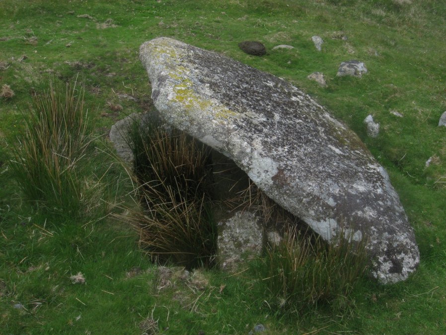
Photo taken on 04-06-2016

Plan by RHW. Barrow Report 19. TDA Vol.32 1900
Database entries
PDW coverage: Dartmoor Site: Guide to the Langcombe Brook & Deadman's Bottom Cists
OS Map: SX 60874 67551
OS Source: Garmin
Butler OS: SX60866754
HER: MDV5085
Megalithic Portal: 45660
PMD: Calveslake Tor
Alternate name: Calveslake Tor
Short Name: CT Calveslak
Butler map: 50.4
Dixon Cist #: 9
Grinsell: SHAUGH PRIOR 3
DPD page: 43
Exist: Yes
Record: Unique
Record Source: Butler
Hut Class: No
Cist Class: Yes
Cairn Class: Yes
Barrow Report: 12 19
Dimensions (m): 8.0 x 0.8 C
Lidar: SX 60874 67551
Guide Map: 50
Nearest Bus Stop: Princetown Dartmoor Visitor Centre (8.1 km) [Route: 98,171(20/07/26 to 19/09/26)]
Nearby sites: SX 60874 67551
Notes
"A perfect, well constructed cist at Calveslake. Length, 3ft 7inches; width at north end,1ft 7 1/2 inches; at south end, 1ft 9inches, depth to floor, 2ft 7inches. An irregular shaped cover-stone overhangs the eastern end of the cist. The barrow in which the cist stands has a diameter of 18 feet." Lethbridge Calves Lake cist p.42-43, diagram p.42. Butler Calveslake Tor - Vol. 3. Map 50.4 (diagram p.154).References
These are selected references with an emphasis on out of copyright sources linked as PDFs. For more detailed references try any linked HER or PMD record above.
- Butler, Jeremy, Dartmoor Atlas of Antiquities, vol.3: The South-West, (1994)
- Grinsell, L.V., Dartmoor Barrows, Devon Archaeological Society Proceedings No.36 (1978)
- Lethbridge, William D., Discover Preshistoric Dartmoor, (2015)
- Worth, R. Hansford, Barrow Report 19, T.D.A. Vol.32 pp.46-54 (1900)
- Worth, R.N., Barrow Report 12, T.D.A. Vol.22 pp.49-52 (1890)