
Skir Hill (Henroost) Ring Setting Cairn and Cist
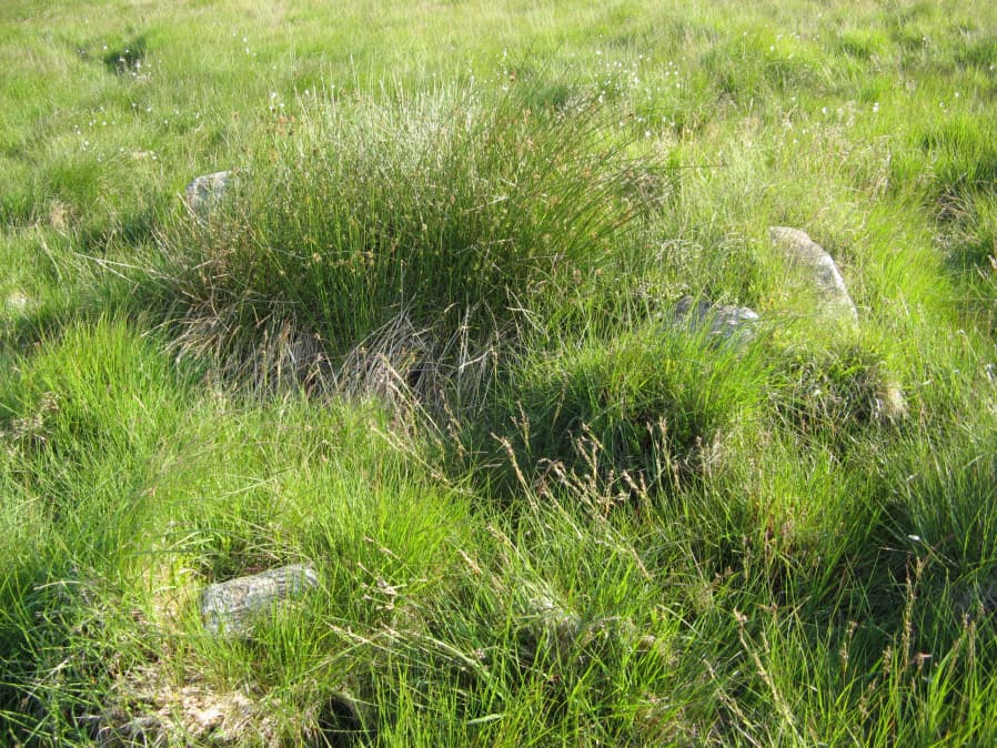
Photo taken on 28-06-2018
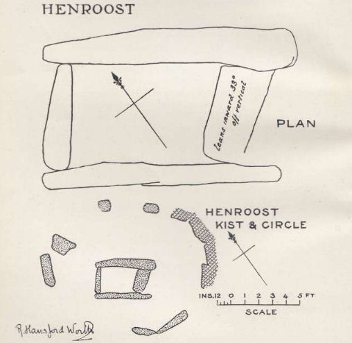
Plan by RHW. Barrow Report 24. TDA Vol.37 1905
Database entries
OS Map: SX 65104 70686
OS Source: Garmin
Butler OS: SX65187075
HER: MDV6507
Megalithic Portal: 45676
PMD: Skir Hill
Alternate name: Skir Hill
Short Name: CT Skir Hill
Butler map: 61.8
Dixon Cist #: 18
Grinsell: LYDFORD 102
Turner: D18
DPD page: 92
Exist: Yes
Record: Unique
Record Source: Butler
Hut Class: No
Cist Class: Yes
Cairn Class: Yes
Barrow Report: 24 56
Dimensions (m): 3.3 C
Lidar: SX 65104 70686
Guide Map: 39
Nearest Bus Stop: Dartmeet Badgers Holt (4.3 km) [Route: 172]
Nearby sites: SX 65104 70686
Notes
DM reports it is actually located at SX 65092 70684. The author has found this site at SX 65104 70691 on 28/06/18 assisted by the grid reference given by Dave Martin (DM). "A Bronze Age cairn containing a cist located on the north east facing slope of Skir Hill 590 metres south of Skir Ford. The cairn survives as a 4.1 diameter ring of edge set slabs up to 0.5 metres high. The cist is situated slightly west of the cairns centre and survives as a 0.82 metres long by 0.52 metres wide and 0.82 metres deep stone lined pit." Formerly listed as being at SX 6517 7075 (as per literature). Butler Vol. 4. Map 61.8 (diagram p.203).References
These are selected references with an emphasis on out of copyright sources linked as PDFs. For more detailed references try any linked HER or PMD record above.
- Butler, Jeremy, Dartmoor Atlas of Antiquities, vol.4: The South-East, (1993)
- Davidson, C. & Seabrook, R., Stone rings on south-east Dartmoor, D.A.S.P. No.31 (1973)
- Grinsell, L.V., Dartmoor Barrows, Devon Archaeological Society Proceedings No.36 (1978)
- Turner, J.R., Ring Cairns, stone circles and related monuments on Dartmoor, D.A.S.P. No.48 pp.27-86 (1990)
- Worth, R. Hansford, Barrow Report 24, T.D.A. Vol.37 pp.87-95 (1905)
- Worth, R. Hansford, Barrow Report 56, T.D.A. Vol.69 pp.75-109 (1937)