
Fox Tor Newtake, North Cist
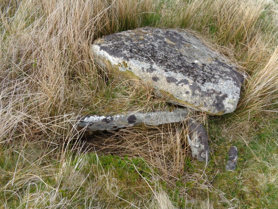
Photo taken on 18-05-2018
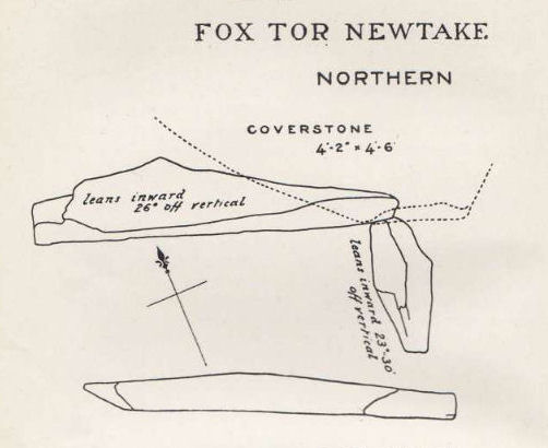
Plan by RHW. Barrow Report 24. TDA Vol.37 1905
Database entries
OS Map: SX 62861 71177
OS Source: Garmin
Butler OS: SX62857117
HER: MDV6303
Megalithic Portal: 45677
PMD: Ter Hill N.
Alternate name: Ter Hill N.W.1
Short Name: CT FoxTorNew N
Butler map: 64.3.1
Dixon Cist #: 19
Grinsell: LYDFORD 97
DPD page: 93
Exist: Yes
Record: Unique
Record Source: Butler
Hut Class: No
Cist Class: Yes
Cairn Class: Yes
Barrow Report: 24 56
Dimensions (m): c.4.0 x 0.3 C
Lidar: SX 62861 71177
Guide Map: 39
Nearest Bus Stop: Two Bridges Hotel (5.6 km) [Route: 98,171,172]
Nearby sites: SX 62861 71177
Notes
"The cist is 0.6m deep and 1.2m long, the NW end is 0.4m wide and SE end 0.6m wide; the NW end-slab, said by Burnard (1905)to be wedged in the bottom cannot be seen. The coverstone, resting on the NE side, is 1.6m by 1.3m at its extremeties". Lethbridge diagram (Cist A) and photo p.93. Butler Ter Hill N.W. 1 - Vol. 4. Map 64.3 (diagram p. 219).References
These are selected references with an emphasis on out of copyright sources linked as PDFs. For more detailed references try any linked HER or PMD record above.
- Butler, Jeremy, Dartmoor Atlas of Antiquities, vol.4: The South-East, (1993)
- Grinsell, L.V., Dartmoor Barrows, Devon Archaeological Society Proceedings No.36 (1978)
- Worth, R. Hansford, Barrow Report 24, T.D.A. Vol.37 pp.87-95 (1905)
- Worth, R. Hansford, Barrow Report 56, T.D.A. Vol.69 pp.75-109 (1937)