
Fox Tor Newtake, South Cist
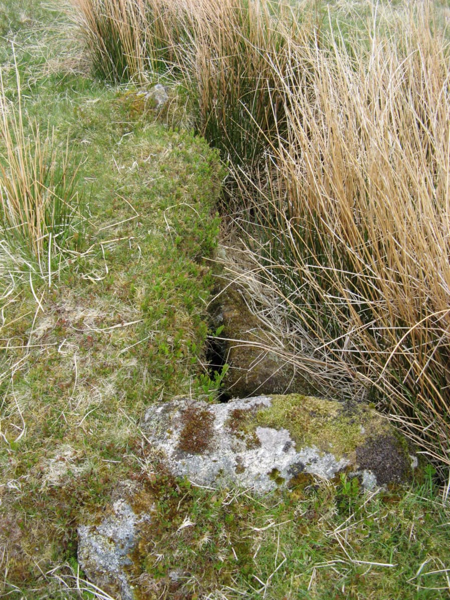
Photo taken on 18-05-2018
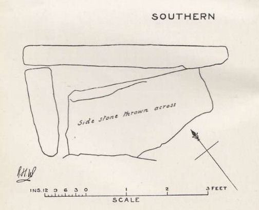
Plan by RHW. Barrow Report 24. TDA Vol.37 1905
Database entries
OS Map: SX 62864 70964
OS Source: Garmin
Butler OS: SX62847098
HER: MDV6279
Megalithic Portal: 45678
PMD: Ter Hill S.
Alternate name: Ter Hill N.W.2
Short Name: CT FoxTorNew S
Butler map: 64.3.2
Dixon Cist #: 20
Grinsell: LYDFORD 98
DPD page: 94
Exist: Yes
Record: Unique
Record Source: Butler
Hut Class: No
Cist Class: Yes
Cairn Class: Yes
Barrow Report: 24 56
Dimensions (m): c.5.0 x 0.3 C
Lidar: SX 62864 70964
Guide Map: 39
Nearest Bus Stop: Two Bridges Hotel (5.9 km) [Route: 98,171,172]
Nearby sites: SX 62864 70964
Notes
"The turf-covered cairn is, at maximum, 3.9m in diameter and 0.3m in height. The cist, oriented NW/SE, is approximately 1.3m by 0.55m, and 0.75m deep, and now almost hidden by the SW side stone which has fallen inwards. The NE end stone is not evident but an 0.7m high upright granite post retains part of the mound on this NE side. There is no trace of the coverstone". Lethbridge diagram p.93 (Cist B), top photos p.94. Butler Ter Hill N.W. 2 - Vol. 4. Map 64.3 (diagram p.219).References
These are selected references with an emphasis on out of copyright sources linked as PDFs. For more detailed references try any linked HER or PMD record above.
- Butler, Jeremy, Dartmoor Atlas of Antiquities, vol.4: The South-East, (1993)
- Grinsell, L.V., Dartmoor Barrows, Devon Archaeological Society Proceedings No.36 (1978)
- Worth, R. Hansford, Barrow Report 24, T.D.A. Vol.37 pp.87-95 (1905)
- Worth, R. Hansford, Barrow Report 56, T.D.A. Vol.69 pp.75-109 (1937)