
Drizzlecombe Cist
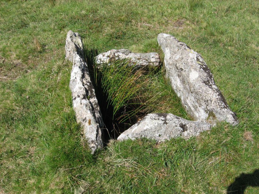
Photo taken on 31-08-2014
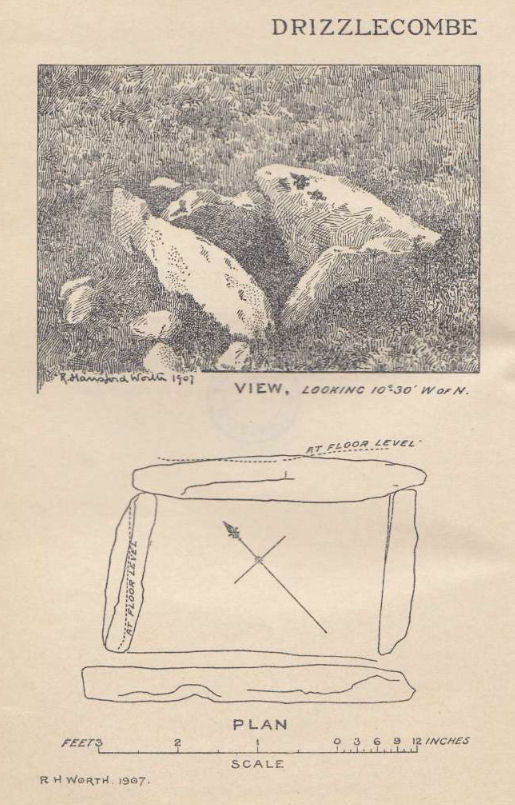
Plan by RHW. Barrow Report 26. TDA Vol.39 1907
Database entries
PDW coverage: Dartmoor Site: Drizzlecombe Ceremonial Complex (Photos 1)
OS Map: SX 59227 67478
OS Source: Google
Butler OS: SX59226747
HER: MDV3363
Megalithic Portal: 16934
PMD: Drizzlecombe N.
Alternate name: Drizzlecombe 21
Short Name: CT Drizzle 21
Butler map: 49.19.21
Dixon Cist #: 21
Grinsell: SHEEPSTOR 24
DPD page: 41
Exist: Yes
Record: Unique
Record Source: Butler
Hut Class: No
Cist Class: Yes
Cairn Class: Yes
Barrow Report: 26 34
Dimensions (m): 1.18 x 0.9 C
Lidar: SX 59227 67478
Guide Map: 48
Nearest Bus Stop: Meavy Primary School (6.2 km) [Route: 56]
Nearby sites: SX 59227 67478
Notes
Butler Vol. 3. Map 49.19.21 (pp.135-142, general plan of Drizzlecombe complex p.135, diagram p.141 Cist 21). Lethbridge p.38-41, diagram p.38 Cist C(3)References
These are selected references with an emphasis on out of copyright sources linked as PDFs. For more detailed references try any linked HER or PMD record above.
- Butler, Jeremy, Dartmoor Atlas of Antiquities, vol.3: The South-West, (1994)
- Grinsell, L.V., Dartmoor Barrows, Devon Archaeological Society Proceedings No.36 (1978)
- Lethbridge, William D., Discover Preshistoric Dartmoor, (2015)
- Worth, R. Hansford, Barrow Report 26, T.D.A. Vol.39 pp.82-83 (1907)
- Worth, R. Hansford, Barrow Report 34, T.D.A. Vol.47 pp.131-3 (1915)