
Joan Ford's Newtake Embanked Cairn Circle and Cist
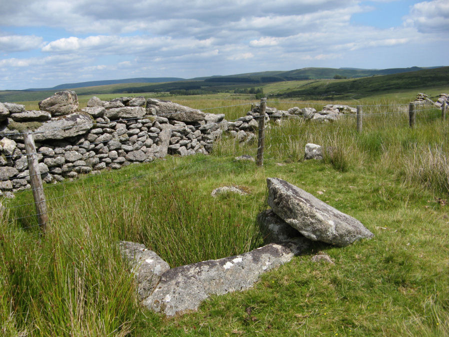
Photo taken on 21-07-2020
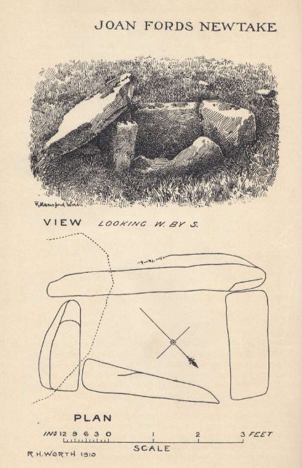
Plan by RHW. Barrow Report 30. TDA Vol.43 1911
Database entries
OS Map: SX 63143 72168
OS Source: Google
Butler OS: SX63147216
HER: MDV6260
Megalithic Portal: 3295
PMD: Joan Ford's Newtake
Alternate name: Joan Ford's Newtake 1
Short Name: CT Joan Fords
Butler map: 63.3.1
Dixon Cist #: 28
Grinsell: LYDFORD 92
Turner: B7
DPD page: 99
Exist: Yes
Record: Unique
Record Source: Butler
Hut Class: No
Cist Class: Yes
Cairn Class: Yes
Barrow Report: 30 56
Dimensions (m): 8.0 x 0.4
Lidar: SX 63143 72168
Guide Map: 39
Nearest Bus Stop: Two Bridges Hotel (4.7 km) [Route: 98,171,172]
Nearby sites: SX 63143 72168
Notes
"A low kerb within the disturbed fringes of the mound is 8.7m in diameter with more or less continuous upright slabs and boulders 0.3m to 0.6m high. A dry stone newtake wall crosses the N side and overlies part of the kerb. A well-preserved cist, oriented NW-SE, is internally 1.0m long, 0.5m to 0.65m wide and up to 0.7m deep. The coverstone leans against the SE side of the cist and measures 1.35m by 1.0m by 0.2." Lethbridge diagram p.99, photo bottom p.99. Butler Joan Ford's Newtake 1 - Vol. 4. Map 63.3 (diagram p.214).References
These are selected references with an emphasis on out of copyright sources linked as PDFs. For more detailed references try any linked HER or PMD record above.
- Butler, Jeremy, Dartmoor Atlas of Antiquities, vol.4: The South-East, (1993)
- Grinsell, L.V., Dartmoor Barrows, Devon Archaeological Society Proceedings No.36 (1978)
- Turner, J.R., Ring Cairns, stone circles and related monuments on Dartmoor, D.A.S.P. No.48 pp.27-86 (1990)
- Worth, R. Hansford, Barrow Report 30, T.D.A. Vol.43 pp.95-6 (1911)
- Worth, R. Hansford, Barrow Report 56, T.D.A. Vol.69 pp.75-109 (1937)