
Blackabrook, South Cist
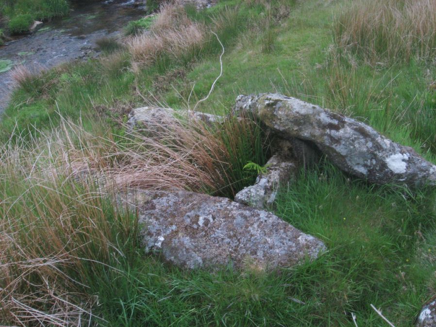
Photo taken on 04-06-2016
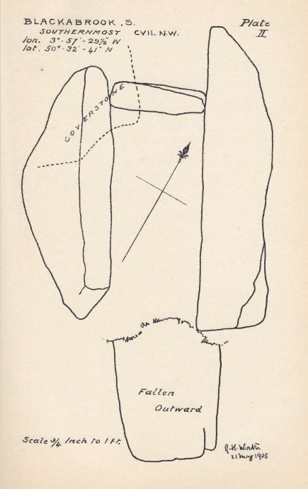
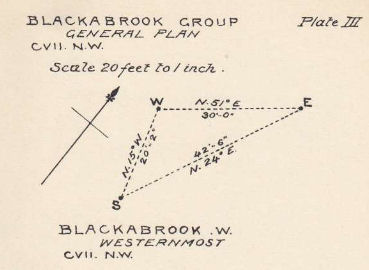
Plan by RHW. Barrow Report 31. TDA Vol.44 1912
Database entries
OS Map: SX 60524 73860
OS Source: Garmin
Butler OS: SX60517384
HER: MDV6254
Megalithic Portal: 45679
PMD: Blackabrook
Alternate name: Round Hill S.E.1
Short Name: CT Blackbrk S
Butler map: 65.3.1
Dixon Cist #: 31
Grinsell: LYDFORD 80
DPD page: 103
Exist: Yes
Record: Unique
Record Source: Butler
Hut Class: No
Cist Class: Yes
Cairn Class: Yes
Barrow Report: 31 44
Dimensions (m): 1.25 x 0.55 C
Lidar: SX 60524 73860
Guide Map: 34
Nearest Bus Stop: Two Bridges Hotel (1.6 km) [Route: 98,171,172]
Nearby sites: SX 60524 73860
Notes
"This cist with its displaced capstone lies on the edge of the river bank. Vestiges of the small surrounding cairn are now hidden under the turf. The chamber of the cist measures 1.25m by 0.55m and about 0.5m deep; the capstone is 1.5m long, 1.1m wide and 0.15m thick. The south stone has fallen outwards." Lethbridge p.103 diagram Black Brook Cist(A), photo p.103. Butler Round Hill S.E. 2. - Vol. 4. Map 65.3 (diagram of cists alongside the Blackbrook pp.230-1).Plan by R.H. Worth of Blackabrook cairn group in Barrow Report 31.
References
These are selected references with an emphasis on out of copyright sources linked as PDFs. For more detailed references try any linked HER or PMD record above.
- Burnard, Robert, Notes on Dartmoor Kistvaens, T.D.A. Vol.22 pp.200-207 (1890)
- Butler, Jeremy, Dartmoor Atlas of Antiquities, vol.4: The South-East, (1993)
- Grinsell, L.V., Dartmoor Barrows, Devon Archaeological Society Proceedings No.36 (1978)
- Prowse, Arthur B., The Antiquities of Ockery and Roundhill, T.D.A. Vol.33 pp.495-499 (1901)
- Worth, R. Hansford, Barrow Report 31, T.D.A. Vol.44 pp.83-5 (1912)
- Worth, R. Hansford, Barrow Report 44, T.D.A. Vol.57 p.71 (1925)