
Blackabrook, West Cist
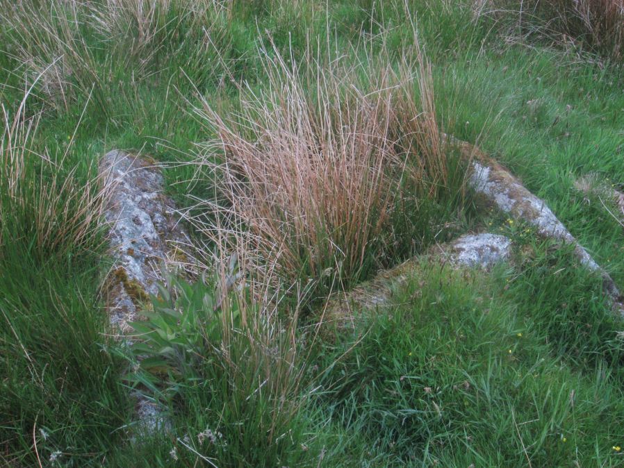
Photo taken on 04-06-2016
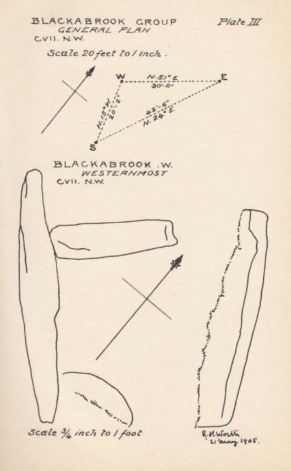
Plan by RHW. Barrow Report 31. TDA Vol.44 1912
Database entries
OS Map: SX 60522 73867
OS Source: Garmin
Butler OS: SX60517385
HER: MDV6253
Megalithic Portal: 45679
PMD: Blackabrook NW.
Alternate name: Round Hill S.E.2
Short Name: CT Blackbrk W
Butler map: 65.3.2
Dixon Cist #: 32
Grinsell: LYDFORD 81
DPD page: 104
Exist: Yes
Record: Unique
Record Source: Butler
Hut Class: No
Cist Class: Yes
Cairn Class: Yes
Barrow Report: 31 44
Dimensions (m): 1.0 x 0.7 C
Lidar: SX 60522 73867
Guide Map: 34
Nearest Bus Stop: Two Bridges Hotel (1.6 km) [Route: 98,171,172]
Nearby sites: SX 60522 73867
Notes
"The reed-filled cist is approximately 1.0m by 0.7m and about 0.2m deep. Peat has accumulated around the sides of the slabs but a few stones evident on the SW side may be part of a robbed cairn." Lethbridge p.103 diagram Black Brook Cist(B), photo p.104. Butler Round Hill S.E. 1 - Vol. 4. Map 65.3 (diagram of cists alongside the Blackbrook pp.230-1). Plan by R.H. Worth of in Barrow Report 31 includes plan of Blackabrook cairn group.References
These are selected references with an emphasis on out of copyright sources linked as PDFs. For more detailed references try any linked HER or PMD record above.
- Burnard, Robert, Notes on Dartmoor Kistvaens, T.D.A. Vol.22 pp.200-207 (1890)
- Butler, Jeremy, Dartmoor Atlas of Antiquities, vol.4: The South-East, (1993)
- Grinsell, L.V., Dartmoor Barrows, Devon Archaeological Society Proceedings No.36 (1978)
- Prowse, Arthur B., The Antiquities of Ockery and Roundhill, T.D.A. Vol.33 pp.495-499 (1901)
- Worth, R. Hansford, Barrow Report 31, T.D.A. Vol.44 pp.83-5 (1912)
- Worth, R. Hansford, Barrow Report 44, T.D.A. Vol.57 p.71 (1925)