
Roundhill, East of Summit Cist
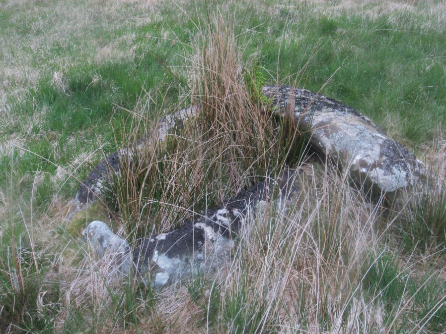
Photo taken on 04-06-2016
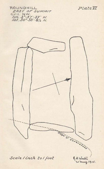
Plan by RHW. Barrow Report 31. TDA Vol.44 1912
Database entries
OS Map: SX 61164 74413
OS Source: Garmin
Butler OS: SX61157440
HER: MDV6257
Megalithic Portal: 45681
PMD: Round Hill E.
Alternate name: Round Hill Summit 2
Short Name: CT Roundhill 2
Butler map: 65.1.2
Dixon Cist #: 35
Grinsell: LYDFORD 79
DPD page: 105
Exist: Yes
Record: Unique
Record Source: Butler
Hut Class: No
Cist Class: Yes
Cairn Class: Yes
Barrow Report: 31 44
Dimensions (m): 1.2 x 0.55 C
Lidar: SX 61164 74413
Guide Map: 34
Nearest Bus Stop: Two Bridges Hotel (0.9 km) [Route: 98,171,172]
Nearby sites: SX 61164 74413
Notes
"A well preserved cist, situated on a slight east-facing slope just off the crest of a rounded hilltop. It stands in isolation on a generally stone-free area of rough moorland pasture. The side slabs are each 1.2m long and up to 0.3m thick and the end slabs are 0.55m long, 0.15m wide and 0.4m long, 0.1m wide respectively. The coverstone is up to 1.6m long, 0.9m wide and 0.2m thick. There are no surface indications of either a cairn or mound around the cist." Lethbridge p.103 diagram Cist(B), photo bottom p.105. Butler Round Hill Summit 2 (Cist 2) - Vol. 4. Map 65.1 (p.227-9, diagram of Round Hill cairns p.228).References
These are selected references with an emphasis on out of copyright sources linked as PDFs. For more detailed references try any linked HER or PMD record above.
- Butler, Jeremy, Dartmoor Atlas of Antiquities, vol.4: The South-East, (1993)
- Grinsell, L.V., Dartmoor Barrows, Devon Archaeological Society Proceedings No.36 (1978)
- Prowse, Arthur B., The Antiquities of Ockery and Roundhill, T.D.A. Vol.33 pp.495-499 (1901)
- Worth, R. Hansford, Barrow Report 31, T.D.A. Vol.44 pp.83-5 (1912)
- Worth, R. Hansford, Barrow Report 44, T.D.A. Vol.57 p.71 (1925)