
Burford Down (Tristis Rock) Platform Cairn Circle and Cist
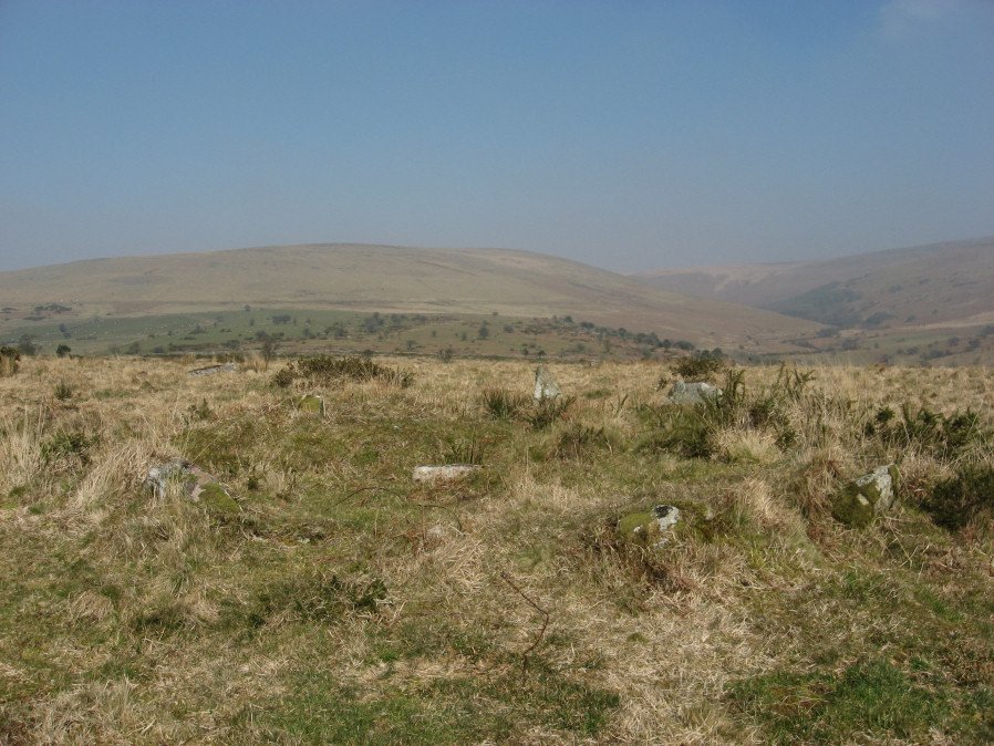
Photo taken on 13-03-2016
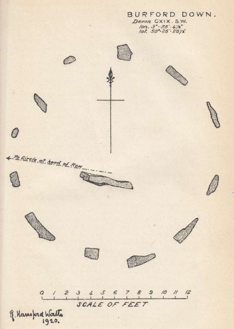
Plan by RHW. Barrow Report 40. TDA Vol.53 1921
Database entries
PDW coverage: Dartmoor Site: Burford Down stone row and cairns
OS Map: SX 6378 6016
OS Source: HER
Butler OS: SX63776015
HER: MDV4258
Megalithic Portal: 45689
PMD: Tristis Rock
Alternate name: Tristis Rock
Short Name: CT TristisRock
Butler map: 54.17
Dixon Cist #: 42
Grinsell: HARFORD 6
Turner: E22
DPD page: 70
Exist: Yes
Record: Unique
Record Source: Butler
Hut Class: No
Cist Class: Yes
Cairn Class: Yes
Barrow Report: 14 40
Dimensions (m): 6.4 x 0.4 C
Lidar: SX 6378 6016
Guide Map: 56
Nearest Bus Stop: Cornwood Crossways (4.4 km) [Route: 59]
Nearby sites: SX 6378 6016
Notes
"Retaining circle of a barrow, internal diameter between 16 and 17 feet and consisting of twelve stones which enclose the remaining south side stone of a cist. The overall length of the side stone is 4 feet 6 inches, the internal length of the cist would not have been more than 3 feet". Butler Tristis Rock - Vol. 4. Map 54.17 (p.60 diagram of Tristis Rock cairn p.59).References
These are selected references with an emphasis on out of copyright sources linked as PDFs. For more detailed references try any linked HER or PMD record above.
- Butler, Jeremy, Dartmoor Atlas of Antiquities, vol.4: The South-East, (1993)
- Davidson, C. & Seabrook, R., Stone rings on south-east Dartmoor, D.A.S.P. No.31 (1973)
- Falcon, T.A., Dartmoor: A Note On Graves, T.D.A. Vol.37 pp.457-461 (1905)
- Grinsell, L.V., Dartmoor Barrows, Devon Archaeological Society Proceedings No.36 (1978)
- Hankin, C. F., An archaeological check-list for Harford, Devon Archaeological Society/DCRA publications no.11 (1982)
- Lethbridge, William D., Discover Preshistoric Dartmoor, (2015)
- Parsons, Hamlyn, Investigations into the Burford Down Stone Row, D.A.S.P. No.85 pp.145-147 (1953)
- Turner, J.R., Ring Cairns, stone circles and related monuments on Dartmoor, D.A.S.P. No.48 pp.27-86 (1990)
- Worth, R. Hansford, The Erme, Yealm and Torry part 1, T.P.I. Vol.11 part 1 pp.173-183 (1892)
- Worth, R. Hansford, Barrow Report 21, T.D.A. Vol.34 pp.104- 146 (1902)
- Worth, R. Hansford, Barrow Report 40, T.D.A. Vol.53 (1921)
- Worth, R.N., The Stone Rows of Dartmoor - Part 1, T.D.A. Vol.24 pp.387-417 (1892)
- Worth, R.N., Barrow Report 14, T.D.A. Vol.24 (1892)