
Dendles Waste Ring Setting Cairn and Cist
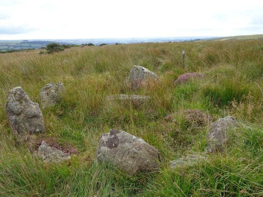
Photo taken on 25-08-2017
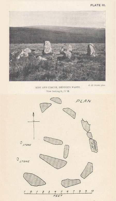
Plan by RHW. Barrow Report 43. TDA Vol.56 1924
Database entries
OS Map: SX 61535 62804
OS Source: Garmin
Butler OS: SX61536279
HER: MDV4276
Megalithic Portal: 45691
PMD: Dendles Waste
Alternate name: Dendles Waste S.
Short Name: CT Dendles 1
Butler map: 52.15
Dixon Cist #: 43
Grinsell: CORNWOOD 14
Turner: D19
DPD page: 64
Exist: Yes
Record: Unique
Record Source: Butler
Hut Class: No
Cist Class: Yes
Cairn Class: Yes
Barrow Report: 43
Dimensions (m): 4.0 C
Lidar: SX 61535 62804
Guide Map: 55
Nearest Bus Stop: Cornwood Crossways (4.4 km) [Route: 59]
Nearby sites: SX 61535 62804
Notes
"The circle, consists of eight flat slabs, set on edge and has an internal diameter of approximately 3.4m. Some of the stones from the western quadrant of the circle are missing; a single earthfast stone is all that survives. The rectangular cist lies roughly centrally within the circle and is oriented E to W. It measures 1.2m long by 0.6m and 0.5m deep with slabs still in place both sides". Lethbridge diagram p.63, photo p.64. Butler Dendles Waste S. - Vol. 3. Map 52.15 (diagram p.194).References
These are selected references with an emphasis on out of copyright sources linked as PDFs. For more detailed references try any linked HER or PMD record above.
- Breton, Henry Hugh, The Forest of Dartmoor, (1990)
- Butler, Jeremy, Dartmoor Atlas of Antiquities, vol.3: The South-West, (1994)
- Davidson, C. & Seabrook, R., Stone rings on south-east Dartmoor, D.A.S.P. No.31 (1973)
- Grinsell, L.V., Dartmoor Barrows, Devon Archaeological Society Proceedings No.36 (1978)
- Turner, J.R., Ring Cairns, stone circles and related monuments on Dartmoor, D.A.S.P. No.48 pp.27-86 (1990)
- Worth, R. Hansford, The Erme, Yealm and Torry part 1, T.P.I. Vol.11 part 1 pp.173-183 (1892)
- Worth, R. Hansford, Barrow Report 43, T.D.A. Vol.56 pp.107-8 (1924)