
Grim's Grave (S) Platform Cairn Circle and Cist
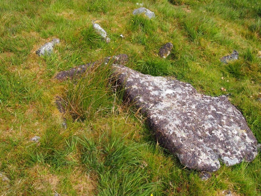
Photo taken on 17-07-2016
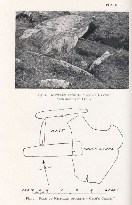
Plan by RHW. Barrow Report 50. TDA Vol.63 1931
Database entries
PDW coverage: Dartmoor Site: Guide to the Langcombe Brook & Deadman's Bottom Cists
OS Map: SX 61251 66313
OS Source: Garmin
Butler OS: SX61246630
HER: MDV5126
Megalithic Portal: 14929
PMD: Langcombe Brook S.
Alternate name: Langcombe Brook 4
Short Name: CT GrimsGraveS
Butler map: 50.3.4
Butler Vol 5: p.160
Dixon Cist #: 47
Grinsell: SHAUGH PRIOR 18
Turner: E8
DPD page: 46
Exist: Yes
Record: Unique
Record Source: Butler
Hut Class: No
Cist Class: Yes
Cairn Class: Yes
Barrow Report: 50
Dimensions (m): 8.0 x 0.4 C
Lidar: SX 61251 66313
Guide Map: 50
Nearest Bus Stop: Lee Moor Clearview (7.8 km) [Route: 59]
Nearby sites: SX 61251 66313
Notes
Lethbridge p.46 Langcombe Cist H - diagram p.43. Butler Langcombe Brook 4 (Cairn 4) - Vol. 3. Map 50.3 (pp.148-54 general plan of Langcombe Brook cairns p.151, diagram of Langcombe cists p.153).References
These are selected references with an emphasis on out of copyright sources linked as PDFs. For more detailed references try any linked HER or PMD record above.
- Butler, Jeremy, Dartmoor Atlas of Antiquities, vol.3: The South-West, (1994)
- Butler, Jeremy, Dartmoor Atlas of Antiquities, vol.5: The Second Millennium B.C., (1997)
- Grinsell, L.V., Dartmoor Barrows, Devon Archaeological Society Proceedings No.36 (1978)
- Lethbridge, William D., Discover Preshistoric Dartmoor, (2015)
- Turner, J.R., Ring Cairns, stone circles and related monuments on Dartmoor, D.A.S.P. No.48 pp.27-86 (1990)
- Worth, R. Hansford, Barrow Report 50, T.D.A. Vol.63 pp.81-82 (1931)
- Worth, R. Hansford, Barrow Report 53, T.D.A. Vol.66 pp.39-42 (1934)