
Outholme Newtake Cist
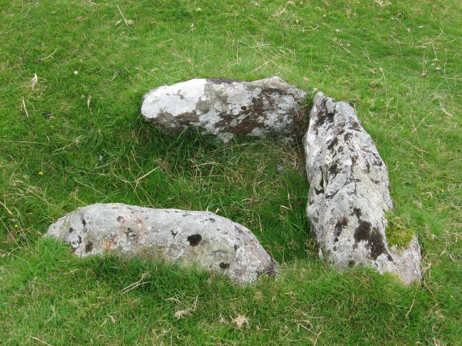
Photo taken on 16-08-2009
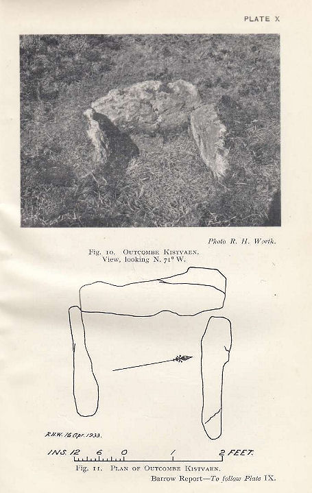
Plan by RHW. Barrow Report 52. TDA Vol.65 1933
Database entries
PDW coverage: Dartmoor Walk: Yellowmead and Drizzlecombe
OS Map: SX 57993 68278
OS Source: Google
Butler OS: SX57996827
HER: MDV4024
Megalithic Portal: 45730
PMD: Outcombe
Alternate name: Outholme Newtake
Short Name: CT OutholmeNew
Butler map: 47.10
Dixon Cist #: 54
Grinsell: SHEEPSTOR 2
DPD page: 30
Exist: Yes
Record: Unique
Record Source: Butler
Hut Class: No
Cist Class: Yes
Cairn Class: Yes
Barrow Report: 52
Dimensions (m): 0.9 x 0.9 C
Lidar: SX 57993 68278
Guide Map: 43
Nearest Bus Stop: Meavy Primary School (4.8 km) [Route: 56]
Nearby sites: SX 57993 68278
Notes
"Located in an isolated pocket of closely cropped grass and surounded by tinners pits. Only three slabs survive in place surrounding a hollow and forming the sides of the cist. The fourth side is missing as is the capstone and any trace of a mound." Lethbridge Outcombe (note different spelling) Cist p.30. Butler Vol. 3. Map 47.10 (diagram p.70).References
These are selected references with an emphasis on out of copyright sources linked as PDFs. For more detailed references try any linked HER or PMD record above.
- Butler, Jeremy, Dartmoor Atlas of Antiquities, vol.3: The South-West, (1994)
- Grinsell, L.V., Dartmoor Barrows, Devon Archaeological Society Proceedings No.36 (1978)
- Lethbridge, William D., Discover Preshistoric Dartmoor, (2015)
- Worth, R. Hansford, Barrow Report 52, T.D.A. Vol.65 pp.83-85 (1933)