
Deadmans Bottom F Platform Cairn Circle and Cist
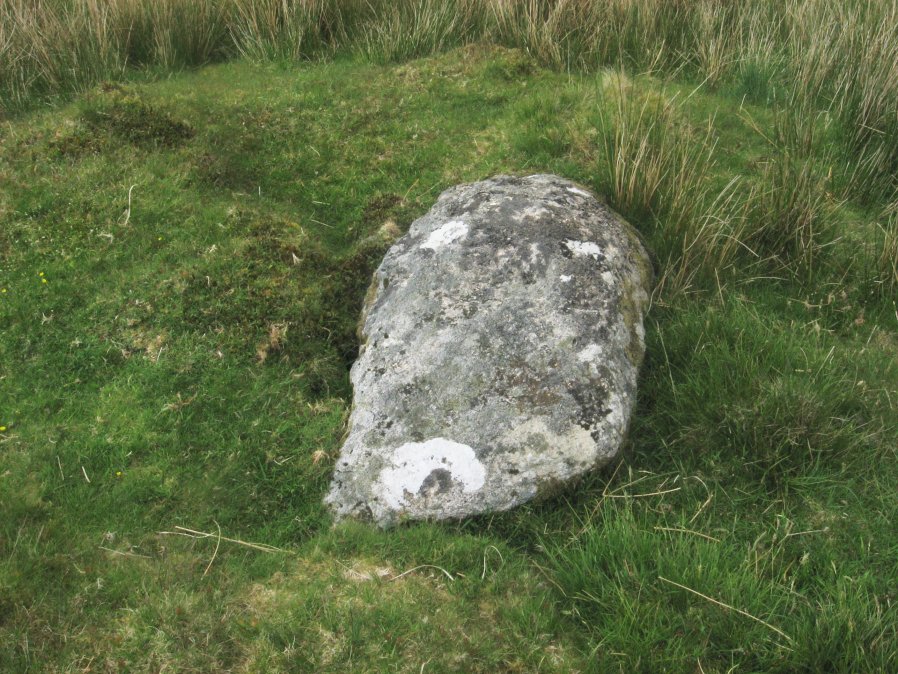
Photo taken on 04-06-2016
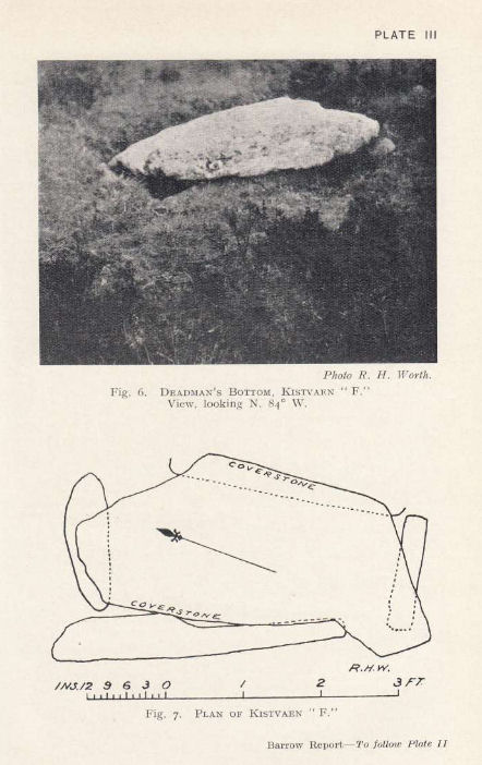
Plan by RHW. Barrow Report 53. TDA Vol.66 1934
Database entries
PDW coverage: Dartmoor Site: Guide to the Langcombe Brook & Deadman's Bottom Cists
OS Map: SX 61201 66983
OS Source: Google
Butler OS: SX61206698
HER: MDV5125
Megalithic Portal: 45733
PMD: Deadman's Bottom E.
Alternate name: Langcombe Brook 11
Short Name: CT Deadmans F
Butler map: 50.3.11
Dixon Cist #: 57
Grinsell: SHAUGH PRIOR 12
DPD page: 43
Exist: Yes
Record: Unique
Record Source: Butler
Hut Class: No
Cist Class: Yes
Cairn Class: Yes
Barrow Report: 53
Dimensions (m): 5.5 x 0.4 C
Lidar: SX 61201 66983
Guide Map: 50
Nearest Bus Stop: Lee Moor Clearview (8.5 km) [Route: 59]
Nearby sites: SX 61201 66983
Notes
"Cist (Listed as 'F' by Worth) found at Deadman's Bottom, Langcombe, by Mr. Button. The cover-stone is still in position but the cist appears to have been rifled, the end and side-stones having been displaced at the north-east and southwest angles. Original length would appear to have been 2 feet 10 inches, and the width 1 foot 7 inches. The greatest length of the cover-stone is 4ft 9 inches and its greatest width 3 feet 1 1/2 inches." ... "A flat-topped cairn measuring 5.4m in diameter and standing a maximum of 0.4m high. A well-preserved cist 1.3m long, 0.6m wide and 0.15m deep is largely obscured by the coverstone". Lethbridge p.43 Langcombe Cist A (Upper Deadman's Bottom) - diagram p.43. nb. Not listed by Turner - assigned as "Platform Circle" type cairn due to description in NMR. Butler Langcombe Brook Cairn 11 - Vol. 3. Map 50.3 (pp.148-54 general plan of Langcombe Brook cairns p.151, diagram of Langcombe cists p.153).References
These are selected references with an emphasis on out of copyright sources linked as PDFs. For more detailed references try any linked HER or PMD record above.
- Butler, Jeremy, Dartmoor Atlas of Antiquities, vol.3: The South-West, (1994)
- Grinsell, L.V., Dartmoor Barrows, Devon Archaeological Society Proceedings No.36 (1978)
- Lethbridge, William D., Discover Preshistoric Dartmoor, (2015)
- Worth, R. Hansford, Barrow Report 53, T.D.A. Vol.66 pp.39-42 (1934)