
Stannon Little Newtake Ring Setting Cairn and Cist
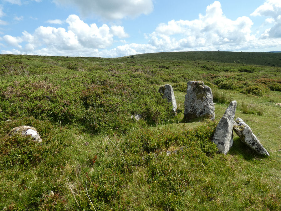
Photo taken on 19-07-2023
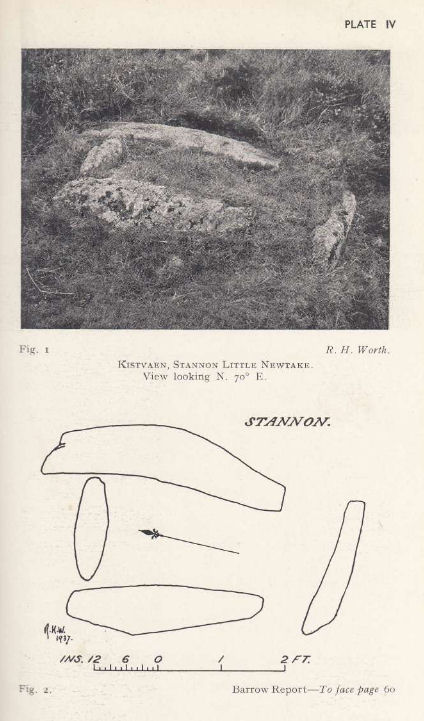
Plan by RHW. Barrow Report 57. TDA Vol.70 1938
Database entries
OS Map: SX 65464 81068
OS Source: Garmin
HER: MDV6616
Megalithic Portal: 37598
PMD: Stannon Newtake
Alternate name: Stannon Newtake E.
Short Name: CT Stannon New
Butler map: 35.21.1
Dixon Cist #: 72
Grinsell: LYDFORD 29
Turner: D16
DPD page: 124
Exist: Yes
Record: Unique
Record Source: Butler
Cist Class: Yes
Cairn Class: Yes
Barrow Report: 57
Dimensions (m): 3.9 x 0.3 C
Lidar: SX 65464 81068
Nearest Bus Stop: Warren House Inn (2.0 km) [Route: 171]
Nearby sites: SX 65464 81068
Notes
"Cairn survives as a 4.5 metre diameter mound up to 0.5 metres high. The western edge is denoted by a kerb of edge set slabs up to 1.15 metres high. The eastern edge is beneath a later boundary bank. A cist in the centre is a rectangular pit 1.2 metres by 0.5 metres denoted by edge set slabs". Butler Stannon Newtake E. - Vol. 2. Map 35.21 (diagram p.168).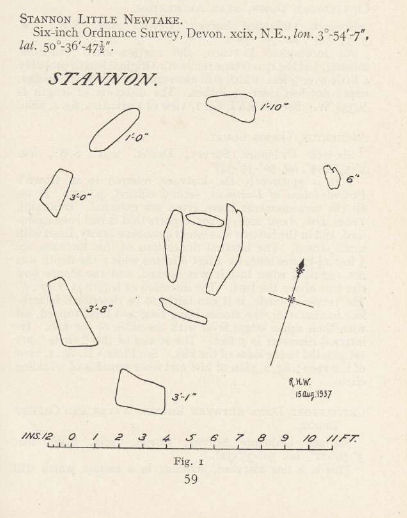
References
These are selected references with an emphasis on out of copyright sources linked as PDFs. For more detailed references try any linked HER or PMD record above.
- Butler, Jeremy, Dartmoor Atlas of Antiquities, vol.2: The North, (1991)
- Falcon, T. A., Dartmoor: A Note On Graves, T.D.A. Vol.37 pp.457-461 (1905)
- Grinsell, L.V., Dartmoor Barrows, Devon Archaeological Society Proceedings No.36 (1978)
- Turner, J.R., Ring Cairns, stone circles and related monuments on Dartmoor, D.A.S.P. No.48 pp.27-86 (1990)
- Worth, R. Hansford, Barrow Report 21, T.D.A. Vol.34 pp.104- 146 (1902)
- Worth, R. Hansford, Barrow Report 57, T.D.A. Vol.70 pp.59-62 (1938)