
Black Newtake (N) No. 1 Ring Setting Cairn and Cist
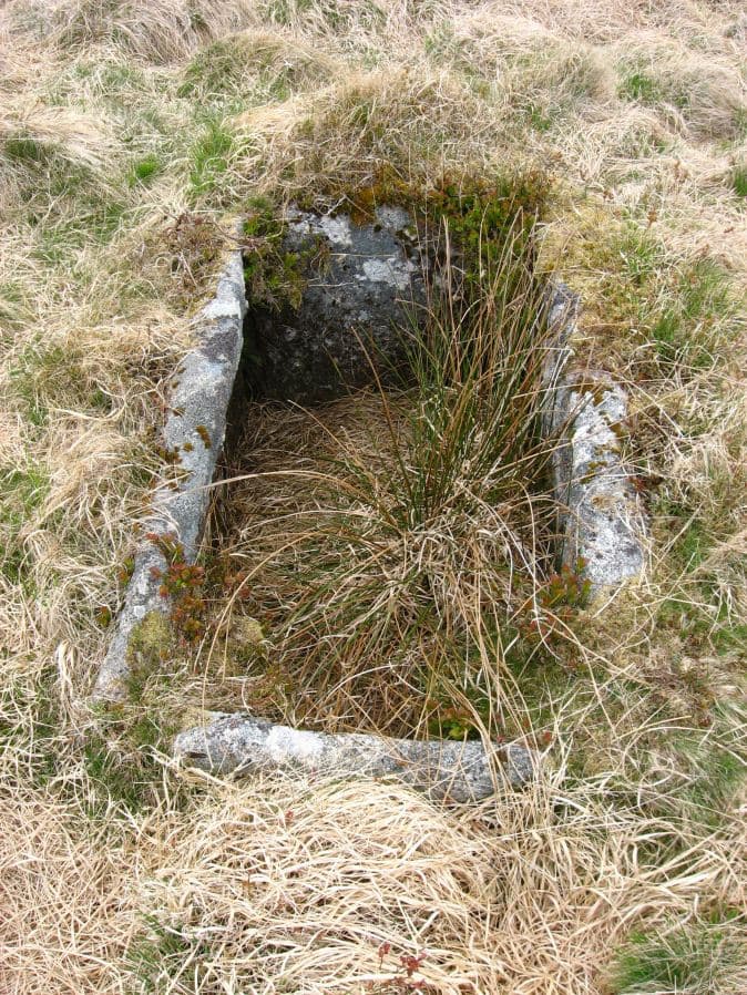
Photo taken on 15-05-2010
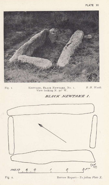
Plan by RHW. Barrow Report 57. TDA Vol.70 1938
Database entries
PDW coverage: Dartmoor Site: Lakehead Hill
OS Map: SX 63919 76067
OS Source: Garmin
Butler OS: SX63917607
HER: MDV5888
Megalithic Portal: 45738
PMD: Black Newtake N.
Alternate name: Bellever Tor 3
Short Name: CT Bellever 3
Butler map: 27.20.3
Dixon Cist #: 78
Grinsell: LYDFORD 60
Turner: D5
DPD page: 119
Exist: Yes
Record: Unique
Record Source: Butler
Hut Class: No
Cist Class: Yes
Cairn Class: Yes
Barrow Report: 57
Dimensions (m): 8.0 x level C
Lidar: SX 63919 76067
Guide Map: 35
Nearest Bus Stop: Powder Mills (1.4 km) [Route: 171]
Nearby sites: SX 63919 76067
Notes
Further coverage on Lakehead Hill page. Lethbridge Cist 1 diagram p.119 and photo top p.119. Butler Bellever Tor (Cairn 3) - Vol. 2. Map 27.20.3 (diagram pp.52-3). Site revisited 04/09/23 and the site is very overgrown unlike in 2010. The exact location by Garmin is SX 63919 76067 now used on this record. See also: Dartmoor Explorations: Antiquities of Black Newtake and EnvironsReferences
These are selected references with an emphasis on out of copyright sources linked as PDFs. For more detailed references try any linked HER or PMD record above.
- Burnard, Robert, Notes on Dartmoor Kistvaens, T.D.A. Vol.22 pp.200-207 (1890)
- Butler, Jeremy, Dartmoor Atlas of Antiquities, vol.2: The North, (1991)
- Grinsell, L.V., Dartmoor Barrows, Devon Archaeological Society Proceedings No.36 (1978)
- Turner, J.R., Ring Cairns, stone circles and related monuments on Dartmoor, D.A.S.P. No.48 pp.27-86 (1990)
- Worth, R. Hansford, Barrow Report 57, T.D.A. Vol.70 pp.59-62 (1938)