
Harrowthorn (North of) Cist
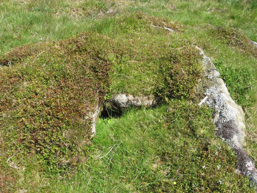
Photo taken on 30-06-2015
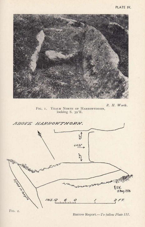
Plan by RHW. Barrow Report 58. TDA Vol.71 1939
Database entries
OS Map: SX 62446 62645
OS Source: Google
Butler OS: SX62456263
HER: MDV4269
Megalithic Portal: 45746
PMD: Harrowthorn Plantation
Alternate name: Coombe Brook N.E.
Short Name: CT Harrowthorn
Butler map: 52.11
Dixon Cist #: 83
Grinsell: CORNWOOD 15
DPD page: 66
Exist: Yes
Record: Unique
Record Source: Butler
Hut Class: No
Cist Class: Yes
Cairn Class: Yes
Barrow Report: 58
Dimensions (m): 4.0 x 0.5 C
Lidar: SX 62446 62645
Guide Map: 55
Nearest Bus Stop: Cornwood Crossways (4.7 km) [Route: 59]
Nearby sites: SX 62446 62645
Notes
"A cist lies 700 yards north of Harrowthorn Plantation and a few feet west of the track from Watercombe Moorgate to Ranny Brook. Only the two side stones and the eastern end stone remain. The structure is unusual in that the southern side stone is an earth fast boulder, an approximately vertical face of which forms a side of the cist." Lethbridge p.66. diagram p.65 Ranny Brook Cist 3. Butler Coombe Brook N.E. - Vol. 3. Map 52.11. Located 200m due east up hill of the Coome Brook enclosure.References
These are selected references with an emphasis on out of copyright sources linked as PDFs. For more detailed references try any linked HER or PMD record above.
- Butler, Jeremy, Dartmoor Atlas of Antiquities, vol.3: The South-West, (1994)
- Grinsell, L.V., Dartmoor Barrows, Devon Archaeological Society Proceedings No.36 (1978)
- Worth, R. Hansford, Barrow Report 58, T.D.A. Vol.71 pp.69-71 (1939)