
Ranny Brook (North of) Cist

Photo taken on 30-06-2015
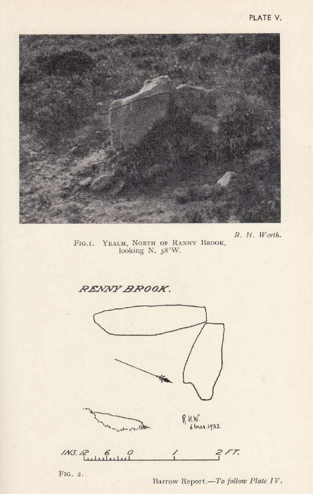
Plan by RHW. Barrow Report 58. TDA Vol.71 1939
Database entries
OS Map: SX 62154 63547
OS Source: Garmin
Butler OS: SX62146353
HER: MDV4272
Megalithic Portal: 45747
PMD: Ranny Brook settlement
Alternate name: Ranny Brook N.3
Short Name: CT Ranny Bk N3
Butler map: 52.9.3
Dixon Cist #: 84
Grinsell: CORNWOOD 11
DPD page: 65
Exist: Yes
Record: Unique
Record Source: Butler
Hut Class: No
Cist Class: Yes
Cairn Class: Yes
Barrow Report: 58
Dimensions (m): 0.68 x 0.22 C
Lidar: SX 62154 63547
Guide Map: 55
Nearest Bus Stop: Cornwood Crossways (5.6 km) [Route: 59]
Nearby sites: SX 62154 63547
Notes
"The northern end-stone and the western side-stone survive, whilst smaller stones may represent the other sides. This agrees with Worth's survey, but in his report he has transposed north and south." Lethbridge diagram p.65 Cist 1. Butler Ranny Brook N. 3 (Cist 3) - Vol. 3. Map 52.9. (pp.184-7 general plan of Ranny Brook settlements and cairns p.184, diagram of cists p.186).References
These are selected references with an emphasis on out of copyright sources linked as PDFs. For more detailed references try any linked HER or PMD record above.
- Butler, Jeremy, Dartmoor Atlas of Antiquities, vol.3: The South-West, (1994)
- Falcon, T.A., Dartmoor: A Note On Graves, T.D.A. Vol.37 pp.457-461 (1905)
- Grinsell, L.V., Dartmoor Barrows, Devon Archaeological Society Proceedings No.36 (1978)
- Worth, R. Hansford, Barrow Report 58, T.D.A. Vol.71 pp.69-71 (1939)