
Dunnabridge Pound Farm Newtake Cist
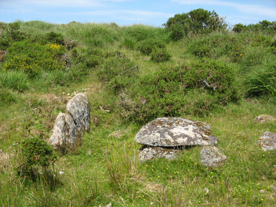
Photo taken on 23-07-2019
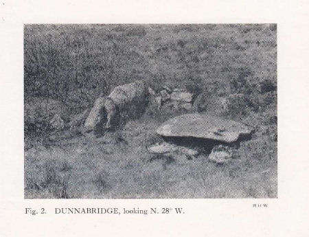
Photo by RHW. Barrow Report 59. TDA Vol.72 1940
Database entries
PDW coverage: Dartmoor Site: Lakehead Hill
OS Map: SX 64086 75691
OS Source: Garmin
Butler OS: SX64087569
HER: MDV5891
Megalithic Portal: 45751
PMD: Dunnabridge Newtake
Alternate name: Bellever Tor 10
Short Name: CT Bellever10
Butler map: 27.20.10
Butler Vol 5: p.60 & Fig.39
Dixon Cist #: 87
Grinsell: LYDFORD 66
DPD page: 121
Exist: Yes
Record: Unique
Record Source: Butler
Hut Class: No
Cist Class: Yes
Cairn Class: Yes
Barrow Report: 59
Dimensions (m): 0.8 x 0.2 C
Lidar: SX 64086 75691
Guide Map: 35
Nearest Bus Stop: Powder Mills (2.0 km) [Route: 171]
Nearby sites: SX 64086 75691
Notes
Only one side of this cist remains. Further coverage on Lakehead Hill page. Lethbridge Cist 4 diagram p.119 and photo top p.121. Butler Bellever Tor - Vol. 2. Map 27.20.10 (Cairn 10 diagram pp.52-3). See also: Dartmoor Explorations: Antiquities of Black Newtake and EnvironsReferences
These are selected references with an emphasis on out of copyright sources linked as PDFs. For more detailed references try any linked HER or PMD record above.
- Butler, Jeremy, Dartmoor Atlas of Antiquities, vol.2: The North, (1991)
- Butler, Jeremy, Dartmoor Atlas of Antiquities, vol.5: The Second Millennium B.C., (1997)
- Grinsell, L.V., Dartmoor Barrows, Devon Archaeological Society Proceedings No.36 (1978)
- Worth, R. Hansford, Barrow Report 59, T.D.A. Vol.72 pp.63-64 (1940)