
Stanlake Cist
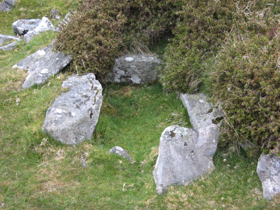
Photo taken on 17-05-2019
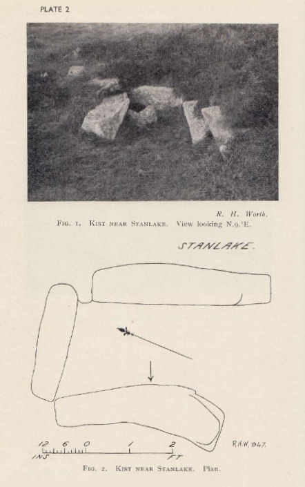
Plan by RHW. Barrow Report 66. TDA Vol.79 1947
Database entries
PDW coverage: Dartmoor Walk: Sharpitor area Stone Rows and Cists
OS Map: SX 56430 70859
OS Source: Google
Butler OS: SX56427085
HER: MDV3746
Megalithic Portal: 45755
PMD: Stanlake W.
Alternate name: Leeden Tor S.2
Short Name: CT LeedenTor 2
Butler map: 45.13.2
Dixon Cist #: 92
Grinsell: WALKHAMPTON 23
Exist: Yes
Record: Unique
Record Source: Butler
Hut Class: No
Cist Class: Yes
Cairn Class: Yes
Barrow Report: 56 66
Dimensions (m): 8.0 x 1.0 C
Lidar: SX 56430 70859
Guide Map: 38
Nearest Bus Stop: Dousland Merrivale View Road (4.3 km) [Route: 55,56]
Nearby sites: SX 56430 70859
Notes
Butler Leeden Tor S. 2 - Vol. 3. Map 45.13 (diagram p.47).References
These are selected references with an emphasis on out of copyright sources linked as PDFs. For more detailed references try any linked HER or PMD record above.
- Butler, Jeremy, Dartmoor Atlas of Antiquities, vol.3: The South-West, (1994)
- Gerrard, Sandy, English Heritage Book of Dartmoor: Landscapes Through Time, (1997)
- Grinsell, L.V., Dartmoor Barrows, Devon Archaeological Society Proceedings No.36 (1978)
- Worth, R. Hansford, Barrow Report 56, T.D.A. Vol.69 pp.75-109 (1937)
- Worth, R. Hansford, Barrow Report 66, T.D.A. Vol.79 pp.31-34 (1947)