
Down Tor N.E. (Eastern) Platform Cairn Circle and Cist
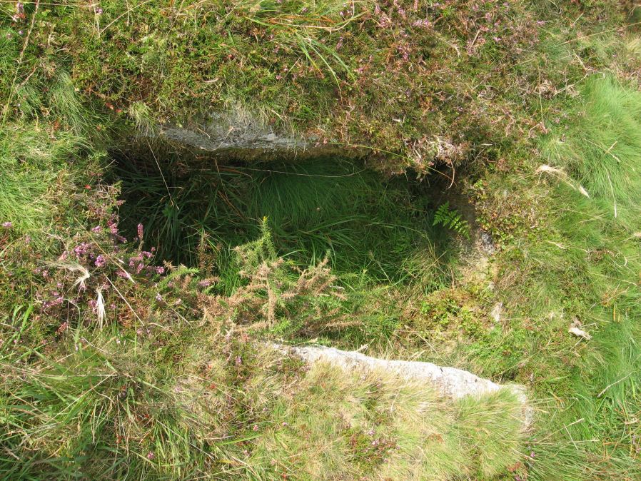
Photo taken on 06-09-2014
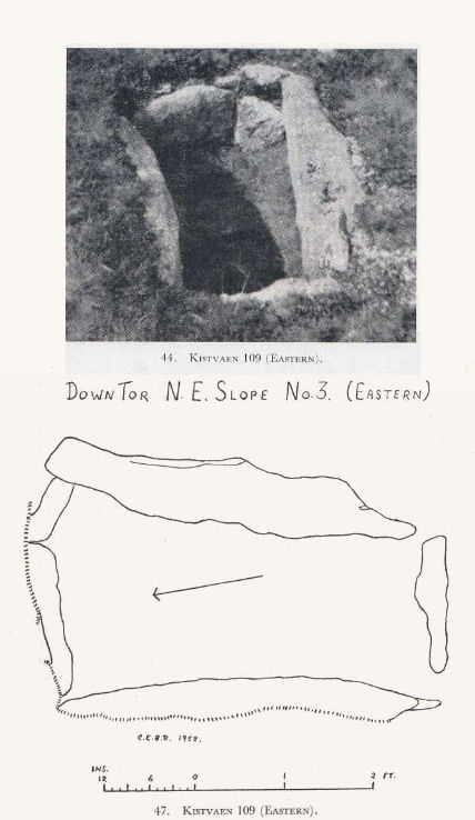
Plan by CEBD. Barrow Report 73. TDA Vol.90 1958
Database entries
OS Map: SX 58397 69562
OS Source: Garmin
Butler OS: SX58396955
HER: MDV3499
Megalithic Portal: 52347
PMD: Down Tor N 3
Alternate name: Hingston Hill N.3
Short Name: CT DownTorNE E
Butler map: 47.13.3
Dixon Cist #: 109
Grinsell: WALKHAMPTON 29
Turner: E34
DPD page: 27
Exist: Yes
Record: Unique
Record Source: Butler
Hut Class: No
Cist Class: Yes
Cairn Class: Yes
Barrow Report: 73
Dimensions (m): 4.2 x 0.6 C
Lidar: SX 58397 69562
Guide Map: 43
Nearest Bus Stop: Princetown Dartmoor Visitor Centre (5.2 km) [Route: 98,171(20/07/26 to 19/09/26)]
Nearby sites: SX 58397 69562
Notes
Butler Hingston Hill N. 3. - Vol. 3. Map 47.13.3 (diagram p.73 OS SX58396955). Grinsell WALKHAMPTON 29 (OS 58276949 approx - same as HER MDV3499). Lethbridge p.27 Cist No.1.Copyright for photos and plans from Barrow Reports 71-73 belongs to the Dixon estate. Reproduced here with kind permission.
References
These are selected references with an emphasis on out of copyright sources linked as PDFs. For more detailed references try any linked HER or PMD record above.
- Butler, Jeremy, Dartmoor Atlas of Antiquities, vol.3: The South-West, (1994)
- Dixon, C.E.B., Barrow Report 73, T.D.A. Vol.90 pp.230-233 (1958)
- Greeves, T, Cramber Tor Training Area Monument Condition Survey, (2012)
- Grinsell, L.V., Dartmoor Barrows, Devon Archaeological Society Proceedings No.36 (1978)
- Lethbridge, William D., Discover Preshistoric Dartmoor, (2015)
- Turner, J.R., Ring Cairns, stone circles and related monuments on Dartmoor, D.A.S.P. No.48 pp.27-86 (1990)