
Beardown Platform Cairn Circle and Cist
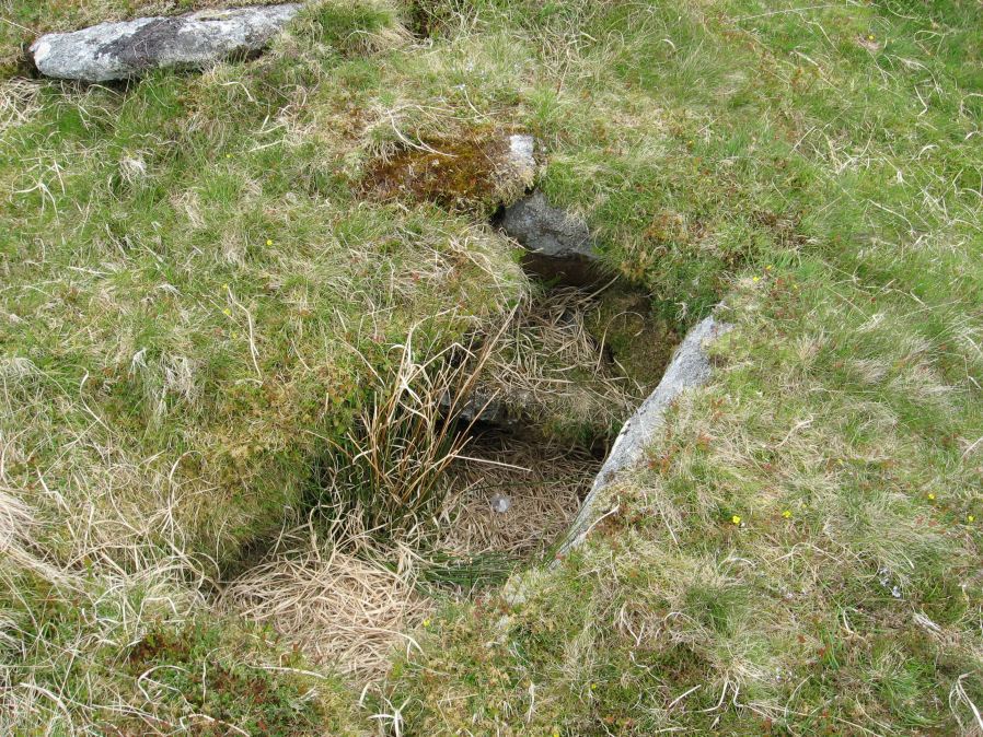
Photo taken on 30-05-2015
Database entries
OS Map: SX 60330 78092
OS Source: Garmin
Butler OS: SX60357808
HER: MDV14690
Megalithic Portal: 42853
PMD: Lydford Tor
Alternate name: Lydford Tor E.
Short Name: CT Beardown
Butler map: 29.17
Butler Vol 5: p.197 & Fig.140
Dixon Cist #: 125
Grinsell: LYDFORD 41a
Turner: E27
DPD page: 109
Exist: Yes
Record: Unique
Record Source: Butler
Hut Class: No
Cist Class: Yes
Cairn Class: Yes
Dimensions (m): 4.5 x 0.4
Lidar: SX 60330 78092
Guide Map: 25
Nearest Bus Stop: Powder Mills (3.9 km) [Route: 171]
Nearby sites: SX 60330 78092
Notes
"The cairn, 4.5 metres by 5.6 metres and 0.4 metres high has spread over the remains of a contiguous kerb 4.6 metres in diameter." ... "Three of the cist slabs lean inwards at the top, the fourth, east slab remains upright. The bottom of the cist contains several slabs. The coverstone is visible to the north west partially buried in the cairn." Lethbridge diagram p.107, photo top p.109. Butler Lydford Tor E Vol. 5. Map 29.17 (diagram Vol 5. p.197).References
These are selected references with an emphasis on out of copyright sources linked as PDFs. For more detailed references try any linked HER or PMD record above.
- Butler, Jeremy, Dartmoor Atlas of Antiquities, vol.2: The North, (1991)
- Butler, Jeremy, Dartmoor Atlas of Antiquities, vol.5: The Second Millennium B.C., (1997)
- Grinsell, L.V., Dartmoor Barrows, Devon Archaeological Society Proceedings No.36 (1978)
- Turner, J.R., Ring Cairns, stone circles and related monuments on Dartmoor, D.A.S.P. No.48 pp.27-86 (1990)