
Kennon Hill Reported Cist
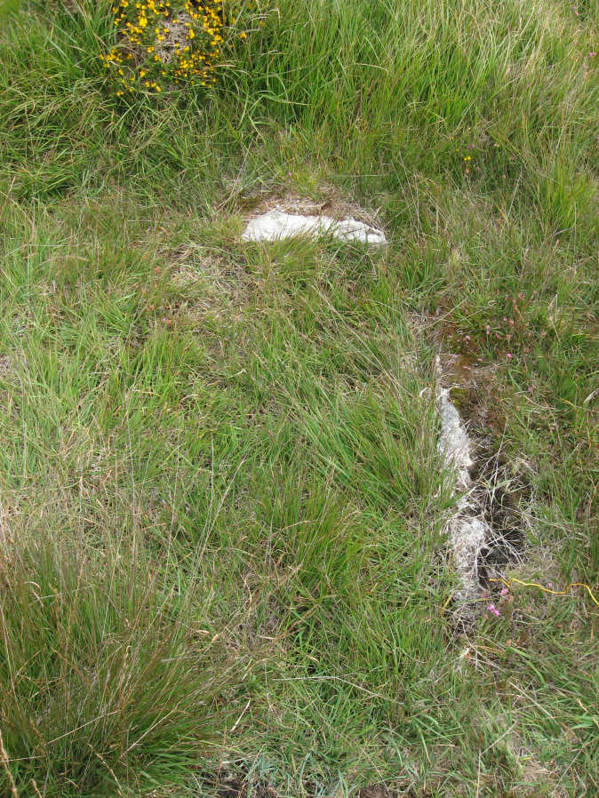
Photo taken on 24-08-2014
Database entries
OS Map: SX 64375 88926
OS Source: Garmin
Alternate name: Kennon Hill
Short Name: CT KennonHill
Butler map: 49.22
Exist: Yes
Record: Unique
Record Source: PDW
Cairn Class: No
Lidar: SX 64375 88926
Nearest Bus Stop (Minor): Wonson Telephone Box (3.0 km) [Route: 670]
Nearest Bus Stop (Major): Ramsley (4.3 km) [Route: 670,671,6A]
Nearby sites: SX 64375 88926
Notes
This looks like a cist but is in fact remains from tar and feather work as identified by Robert Naylor. This photo taken in August 2014 by the author and labelled as "looks like a cist" and marked as a Garmin waypoint "cist?". Located on the southern slope of Kennon Hill in an area of very deep tussocky grass. The author was unable to get back to check it out and posted about this on 4 February 2020 on a Dartmoor Facebook group. The author is grateful to Robert Naylor for having checked it out and clarifying that it is not a cist. Listing here as not a cist will help those in future who stumble across this. For more on this thanks to Max Piper and Dartefacts, see: feather-and-tare-cist-on-kennon-hillReferences
These are selected references with an emphasis on out of copyright sources linked as PDFs. For more detailed references try any linked HER or PMD record above.
- Butler, Jeremy, Dartmoor Atlas of Antiquities, vol.3: The South-West, (1994)