
Giant's Basin Cairn
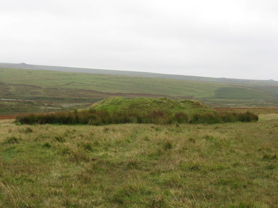
Photo taken on 09-09-2012
Database entries
PDW coverage: Dartmoor Site: Drizzlecombe Ceremonial Complex (Photos 1)
OS Map: SX 59202 66945
OS Source: Google
Butler OS: SX59196694
HER: MDV3372
Megalithic Portal: 538
Alternate name: Giant's Basin
Short Name: CN GiantsBasin
Butler map: 49.19.5
Grinsell: SHEEPSTOR 33
DPD page: 40
Exist: Yes
Record: Unique
Record Source: Butler
Hut Class: No
Cairn Class: Yes
Dimensions (m): 22.0 x 3.5
Lidar: SX 59202 66945
Guide Map: 48
Nearest Bus Stop: Meavy Primary School (6.2 km) [Route: 56]
Nearby sites: SX 59202 66945
Notes
The Giant's Basin is an impressive but heavily disturbed cairn lying adjacent to the Drizzlecombe Stone Rows. It measures approximately 22 metres in diameter, a maximum of 3 metres high and is partially turf-covered. An approximately 2.5 metre wide reed-covered slight depression around its circumference suggests a silted ditch. Much of the central part of the cairn has been removed to a depth of 1.65m and most of excavated material in the form of fist-sized stones and small boulders has been deposited around the rim of the mound.Grinsell [Folklore 1976]: This is named from the large crater in the top where it has been opened. Lethbridge pp.38-42, diagram p.38.
References
These are selected references with an emphasis on out of copyright sources linked as PDFs. For more detailed references try any linked HER or PMD record above.
- Butler, Jeremy, Dartmoor Atlas of Antiquities, vol.3: The South-West, (1994)
- Grinsell, L.V., Grinsell, Folklore of Prehistoric Sites in England, (1976)
- Grinsell, L.V., Dartmoor Barrows, Devon Archaeological Society Proceedings No.36 (1978)
- Lethbridge, William D., Discover Preshistoric Dartmoor, (2015)
- Worth, R. Hansford, The Moorland Plym, T.P.I. Vol.10 Part 3 p.294 (1890)
- Worth, R.N., Barrow Report 12, T.D.A. Vol.22 pp.49-52 (1890)