
Aller Brook E Cist
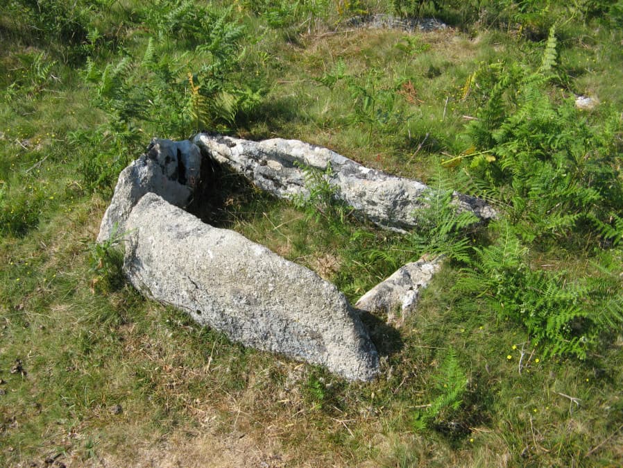
Photo taken on 28-06-2018
Database entries
OS Map: SX 67813 71682
OS Source: Garmin
Butler OS: SX67827167
HER: MDV126409
Megalithic Portal: 45799
PMD: Aller Brook E.
Alternate name: Aller Brook E.
Short Name: CT Aller Brk E
Butler map: 60.11
Dixon Cist #: 144
DPD page: 90
Exist: Yes
Record: Unique
Record Source: Butler
Hut Class: No
Cist Class: Yes
Cairn Class: Yes
Dimensions (m): 1.0 x 0.5 C
Lidar: SX 67813 71682
Guide Map: 40
Nearest Bus Stop: Dartmeet Badgers Holt (2.1 km) [Route: 172]
Nearby sites: SX 67813 71682
Notes
Butler Vol. 4. Map 60.11 (diagram p.181). only the four sides of the cist remain (1.0 x 0.5m), orientated WNW. Around it are two or three flat slabs of the retaining circle but the cover stone has gone as have all traces of the mound Lethbridge diagram and photo bottom left p.90.NB. The HER entry MDV126409 is duplicated with MDV20166 - see also SiteID=1842
References
These are selected references with an emphasis on out of copyright sources linked as PDFs. For more detailed references try any linked HER or PMD record above.
- Butler, Jeremy, Dartmoor Atlas of Antiquities, vol.4: The South-East, (1993)
- Lethbridge, William D., Discover Preshistoric Dartmoor, (2015)
- Newman, Phil; Probert, S. A. J, Holne Moor, Dartmoor, Devonshire. A Landscape Survey, Royal Commission on the Historical Monuments of England (1997)